Quantcast
Channel: WORLD, COME TO MY HOME!
Viewing all 2426 articles
Browse latest View live

0416-0418 & 0900 ROMANIA (Suceava) - Gura Humorului from summer to winter

$
0
0

Posted on 15.12.2012, completed on 13.12.2013
Located in the north-east of Romania, in southern Bukovina, in Humorului Depression, at the confluence of Moldova River and Humor River, between forested ridges of Obcina Mare, Obcina Voroneţului and Obcina Humorului, Gura Humorului has almost 14,000 inhabitants (declining inthe last two decades). From geographically, obcina indicates in Romanian some type of relief, with prolonged ridges, not very high, separated by parallel valleys, and etymologically, it remembers of common property of the free peasants on forests and grazing from these heights. In nowadays the town administers the former village Voroneţ (which became a neighborhood - in the second postcard in right), site of Voroneţ Monastery, one of the eight which formes the UNESCO World Heritage Site named Churches of Moldavia. Another one, namely Humor Monastery, is at only 5km.


The first documentary mention of the settlement dates from 1490, in a document issued by the chancellery of Ştefan cel Mare. In 1782, seven years after the annexation of northern Moldavia by the Habsburg Empire, region called since then Bukovina (I wrote about that here), in Gura Humorului is moved Austrian military commander, which built here a fortress. After 1800, in the settlement began to establish Germans, Poles, Ukrainians, Rusyns and Hungarians, who founded in 1835 a colony named Bori. Since this year, began to settle here numerous Jews, who formed in 1869 around a third of the settlement's population. On May 11, 1899 a disastrous fire destroyed most of the settlement, but was rebuilt soon after, with donations from the United States Jewish communities, and in 1904 it received city status. On October 10, 1941 the fascist regime deported virtually all the Jewish community (2,945 people) to Transnistria, where most of them perished.


In the fourth postcard is the intersection of the road E576 (Suceava - Cluj-Napoca) and DJ177 (which leads to Humor Monastery), surprised by Marius Vasiliu in winter, exactly on December 21, 2012 (Ready for Christmas). In the distance can be seen the Cathedral of the Nativity of the Theotokos, completed in 2011, 16 years after the putting of the cornerstone. A wonderful postcard representing the map of Gura Humorului you can find here


Read more »

0901 UZBEKISTAN (Samarqand) - Samarkand - Crossroad of Cultures (UNESCO WHS)

$
0
0

Along with Bukhara, Samarkand, located in a large oasis in the valley of the Zerafshan River, is one of the oldest inhabited cities in the world, prospering from its location on the trade route between China and the Mediterranean (Silk Road). With a history of over two and a half millennia, it was the crossroads of world cultures, having its most significant development between 14th and 15th centuries, when it was capital of the powerful Temurid realm. Founded c. 700 BC by the Sogdians, it was successively conquered by Alexander the Great, Sassanians, Hephtalites, Göktürks, Sassanids, and Umayyad Caliphate. During this period, Samarkand was home to a number of religions, including Buddhism, Zoroastrianism, Manichaeism, Judaism and Nestorian Christianity, but after the Arab conquest of Sogdiana, Islam became the dominant religion.

Read more »

0902 CHRISTMAS (Luxembourg) - Frohe Weihnachten

$
0
0

Frohe Weihnachten means "Merry Christmas" in German, but I believe that also in Luxembourgish, two of the three administrative languages of Luxembourg (the third is French). The vivid and bright colors delight the eye and gladden the soul, and the onion-shaped domes and the ogee arches leads my mind to the stories of One Thousand and One Nights.

Read more »

0903 CHRISTMAS (Australia) - Baubles

$
0
0

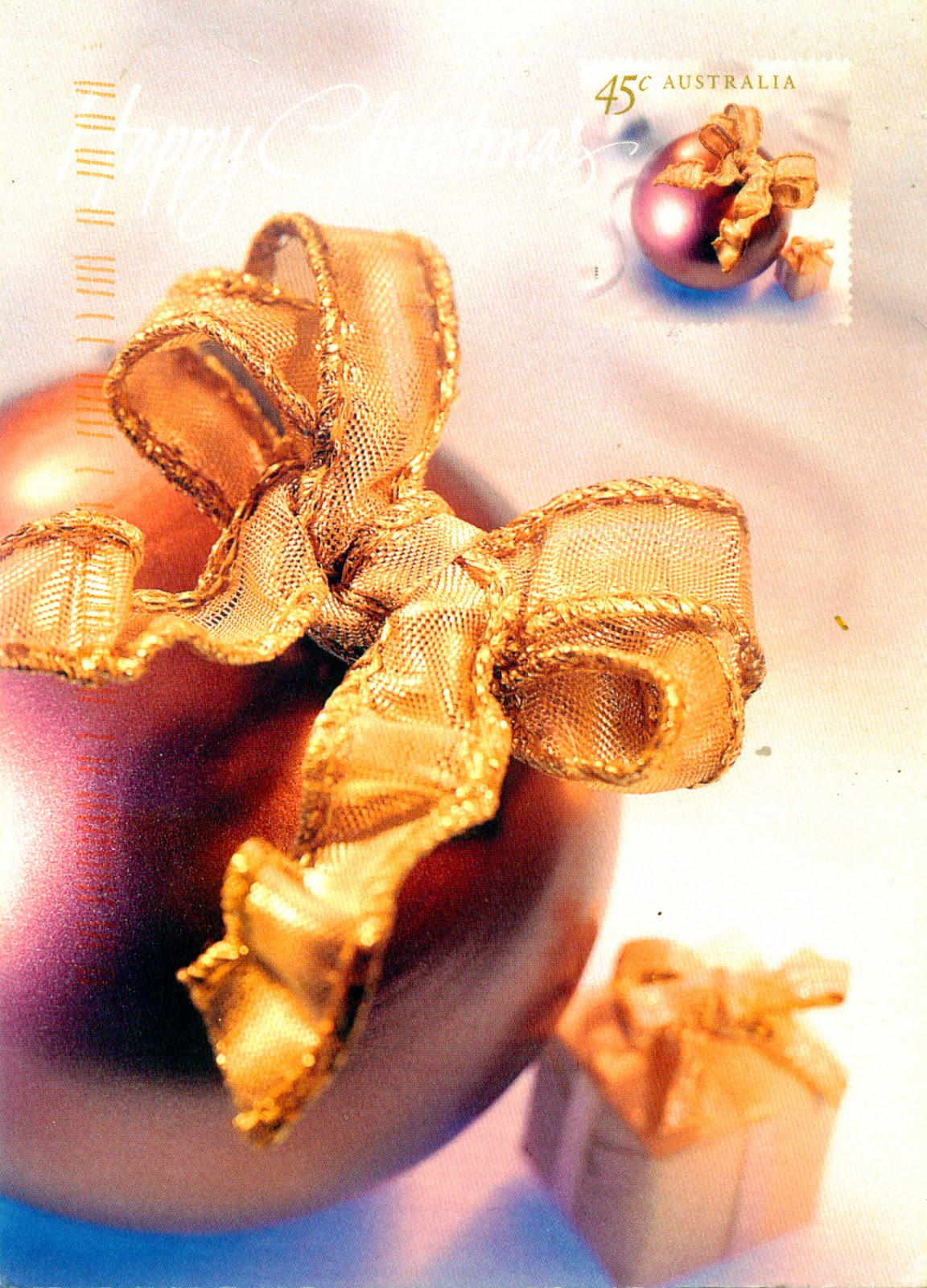
The custom of the Christmas tree developed in modern Germany (with predecessors that can be traced to the 16th century), from where it spread to Europe in the 19th century, and after WWI in many other countries worldwide. It's frequently traced to the symbolism of evergreen trees in pre-Christian winter rites. The tree was traditionally decorated with edibles such as apples (symbolizing the fruit of the tree of knowledge of good and evil), nuts, and later candies, and in the 18th century it began to be illuminated by candles, now replaced by Christmas lights. In the modern era apples and nuts were replaced by baubles, small hollow glass or plastic spheres coated with a thin metallic layer to make them reflective.

Read more »

0406, 0407 & 0906 BRAZIL (Federal District) - Brasilia, a fantasy island (UNESCO WHS)

$
0
0
Posted on 08.12.2012, and completed on 16.12.2013
I received the first postcard from this post on December 5 (even if the postmark is from December 4), the day that has passed away, at the age of almost 105 years, the architect Oscar Niemeyer, one of the key figures in the development of modern architecture, best known for his design of civic buildings for Brasília, among which is the one from the first picture, housing the National Congress. In the master's obituary,  The Economist wrote: "More than any other individual, Oscar Niemeyer could claim to have created Brazil's image as a self-consciously modern country. Brazil's most famous architect turned the functionalism of Le Corbusier into a sensual minimalism that was at once daring and restrained. His motto was not that form follows function but that form follows beauty. Like the functionalists he worked in reinforced concrete, but found poetry in it. He rejected right angles in favour of the liberated, sensual curves found in the mountains of my country, in the sinuousness of its rivers, in the waves of the ocean, and on the body of the beloved woman - shapes displayed in the stunning setting and bright, clear sunlight of his home city, Rio de Janeiro."

In September 1956, soon after he assumed the Brazilian presidency, Juscelino Kubitschek visited Niemeyer and spoke to the architect about his most audacious scheme: "I am going to build a new capital for this country and I want you to help me […] Oscar, this time we are going to build the capital of Brazil." Niemeyer organized a competition for the lay-out of the new capital, and the winner was the project of his master and great friend, Lúcio Costa. Following, Lúcio designed the plan of the city, and Niemeyer the buildings, such as the residence of the President (Palácio da Alvorada), the House of the deputy, the National Congress of Brazil, the Cathedral of Brasília, diverse ministries, and residential buildings.


Built ex nihilo in only four years, between 1956 and 1960, in the Brazilian Highlands, in the barren center of the country, at hundreds of kilometers from any major city, Brasilia benefited from new concepts of city planning: streets without transit, buildings floating off the ground supported by columns and allowing the space underneath to be free and integrated with nature. Initially, all the city's apartments were owned by the government and rented to its employees, so that the ministers and common laborers have shared the same building. Of course, the next presidents changed this concept.

The National Congress building (the first postcard), located in the middle of the Monumental Axis, the main avenue in Brasília, consists of two semi-spheres (the left one is the seat of the Senate, and the right one is the seat of the Chamber of the Deputies), which have between them two vertical office towers. The design suggests a balance, with two opposing sides intersected by a symbol of equality. The Congress also occupies other surrounding office buildings, some of them interconnected by a tunnel.


The JK Memorial (the second postcard) is a museum opened on September 12, 1981 and dedicated to Juscelino Kubitschek, as I say, the founder of the city of Brasilia. On site are the body of JK, many belongings as his personal library, and photos of him as both his wife Sarah. Featuring works designed by Athos in the outdoor area, a stained glass window designed by artist Marianne Peretti on the vault and a 4.5m sculpture authorship of Honorius Peçanha.

In the third postcard is the Monument to the Candango, known also as Os Guerreiros (The Warriors), a work in bronze of the Italian Brazilian sculptor Bruno Giorgi. It is the centerpiece of Brazil's governmental plaza, Praça dos Três Poderes (Three Powers Plaza), and was erected to pay homage to the thousands of workers who built Brasilia, whose nickname were "candango". The sculpture has become the symbol of the city.

Read more »

0907-0910 MALTA - City of Valletta (UNESCO WHS)

$
0
0

Malta's strategic location tempted many throughout history, so a succession of powers (including the Phoenicians, Greeks, Carthaginians, Romans, Byzantines, Moorish, Normans, Aragonese, Habsburg Spain, Knights of St. John, French and the British) ruled the island, but I dare to say that its name remained in our minds linked to the Knights of St. John, also known as the Knights Hospitaller, who completed here in 1523 the pilgrimage made ​​under the pressure of Islam, which pushed them from the Kingdom of Jerusalem in the Kingdom of Cyprus (1291), then in the island of Rhodes (1309). Valletta was born when the Order decided to found a new city on the Xiberras peninsula to fortify its position in the island, and the Grandmaster, Jean Parisot de Valette, laid the foundation stone of Our Lady of Victories Church. The official name was Humilissima Civitas Valletta (The Most Humble City of Valletta), but not long after, the ruling houses of Europe gave the city the nickname Superbissima (Most Proud).


The Italian engineer Francesco Laparelli designed the city on a rectangular grid, the planning being carried out by Girolamo Cassar. The fortification and the uniform urban plan of Valletta were inspired by architectural principles of the Italian Renaissance in combination with techniques of contemporary city-planning and aesthetic considerations of urban theorists. The streets were designed to be wide and straight, beginning centrally from the City Gate and ending at Fort Saint Elmo overlooking the Mediterranean. The improvements attributed to the military engineers and architects of the 18th century haven't disturbed this harmony. Even if under the British rule has been built massive, and Nazi air raids throughout WWII caused much destruction, Valletta’s 320 monuments, all within an area of 55 ha, make it one of the most concentrated historic areas in the world, for which reason it was designated by UNESCO an World Heritage Site in 1980.


In the first postcard, in foreground can be seen the part of Valletta from Marsamxett Harbour (Marsamuscetto), with Manoel Island (named after the fort with the same name, a marvel of 18th century military engineering.) and Sliema in background. In the second postcard is the Grandmaster's Palace, which currently houses the House of Representatives of Malta and the office of the President of Malta. It was one of the first buildings in Valletta, erected in 1571 around two courtyards. Its Armoury house one of the finest collections of Medieval and Renaissance weapons in all of Europe, and it also features Gobelins tapestries and frescos by Matteo Perez d'Aleccio (a student of Michelangelo) among other treasures.


St John's Co-Cathedral (in the third postcard) was built between 1573 and 1578, having been commissioned by Grand Master Jean de la Cassière as the conventual church of the Order. Designed by the Maltese military architect Glormu Cassar (Girolamo Cassar), it is considered one of the finest examples of high Baroque architecture in Europe and one of the world's great cathedrals. The interior, in sharp contrast with the severe facade, is extremely ornate, being largely decorated by Mattia Preti. He designed the intricate carved stone walls and painted the vaulted ceiling and side altars with scenes from the life of St John. The whole marble floor is an entire series of tombs, housing about 375 Knights and officers of the order, and into a crypt are the tombs of several Grandmasters.

In the cathedral's Oratory is the only signed work and largest painting by Michelangelo Merisi da Caravaggio (1571–1610), The Beheading of Saint John the Baptist (1608). Restored in the late 1990s in Florence, this painting is one of Caravaggio's most impressive uses of the chiaroscuro style for which he is most famous with a circle of light illuminating the scene of St John's beheading at the request of Salome.

Read more »

0913 CZECH REPUBLIC (Zlin) - Children from Haná in traditional costumes

$
0
0


In addition to its agricultural productivity, Haná (or Hanakia), an ethnic region in central Moravia, located mainly in the lowlands of the Morava River and the Bečva River, is known for its costumes, traditional customs, and Hanakian dialect, still spoken nowadays. The traditional clothes fully correspond to the character of the region, i.e. are dignified and attractive. The male attire can give the impression of being too opulent and boastful, but it's very beautiful, and has the most varied accessories. The most interesting of these comprised leather Haná belts made in the vicinity of Litovel, which were adorned with fine metal strips hammered into them and often combined with embroidery of very narrow straps of multicolored leather.

Read more »

0914 CHINA (HONG KONG) - A man with a rickshaw

$
0
0

The rickshaw began as a two or three-wheeled passenger cart, called a pulled rickshaw, generally pulled by one man with one passenger, and it is believed to have been invented in Japan in the 1869, after the lifting of the ban on wheeled vehicles from the Tokugawa period (1603-1868). The first known use of the term was in 1887, and originates from the Japanese word jinrikisha (jin = human, riki = power or force, sha = vehicle). Pulled rickshaws created a popular form of transportation, and a source of employment, within Asian cities in the 19th century, but their popularity declined when cars, trains and other forms of transportation became widely available.

Read more »

0915 GERMANY (Bremen) - The statue of the Town Musicians

$
0
0

The bronze statue on the western side of the Town Hall, near its entrance, is undoubtedly the most famous and most photographed representation of Die Stadtmusikanten (The Town Musicians), which portrays the donkey, dog, cat and rooster of the Grimm Brothers' fairy tale. The donkey's front legs are shinier than the rest of the statue, as rubbing them is thought to bring good luck. The statue was commissioned by the Verkehrsverein der Freien Hansestadt Bremen e.V. and created by Gerhard Marcks (1889-1981), being installed in 1953, initially on loan from Marcks' workshop. Dr Hanns Meyer, head of the tourism organisation, appealed to Bremen's community spirit and collected donations to make the animals' home permanent. Aided by a loan from the city, the pyramid of animals standing one on top of the other was purchased for 20,000 deutschmarks.

About the stamp

The stamp, issued on 2013, commemorates 50 years of the Fehmarn Sound Bridge, which connects the island of Fehmarn with mainland Germany.

Read more »

0916 CANADA (Ontario) - Post Office and Town Clock at Eganville

$
0
0

Eganville is a small community occupying a deep limestone valley carved at the Fifth Chute of the Bonnechere River, in the township of Bonnechere Valley (formed in 2001 by the union of Grattan, Sebastopol, South Algona and Eganville). The power of the river has been harnessed since 1848, but it was John Egan's grist mill that gets credit for stimulating the town's growth, which took his name. In 1911, a great fire destroyed many of the buildings in Eganville. A year later, the Municipal Building was erected, and served as the village post office until 1973. In 2001 the building became the home of the Bonnechere Museum and one of the most well known symbols of Eganville.

Read more »

0917 PALESTINE (Nablus) - Nabulsi soap

$
0
0

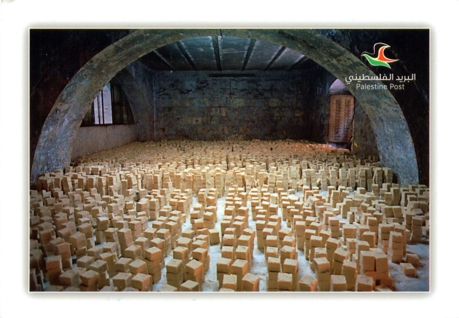
Located in a strategic position between Mount Ebal and Mount Gerizim, in the northern West Bank, at 49km north of Jerusalem, Nablus is a city with a history of over two millennia that entered in 1995 under the jurisdiction of the Palestinian National Authority, become in 2012 the State of Palestine.Founded by Romans in 72 BC, the city knew in the 5th and 6th centuries a conflict between the Christians and Samaritans, which climaxed in a series of Samaritan revolts against Byzantine rule. In 636 it came under the rule of the Islamic Arab Caliphate of Umar ibn al-Khattab, and in 1099 the Crusaders took control of the city, leaving its mixed Muslim, Christian and Samaritan population undisturbed. Conquered by Saladin in 1187, then by the Mamluk in 1260, it was incorporated in Ottoman Empire in 1517. After the loss of the city to British forces during WWI, Nablus was incorporated into the British Mandate of Palestine in 1922, and later designated to form part of the Arab state of Palestine under the 1947 UN partition plan. During the 1948 Arab-Israeli War, the city was captured and occupied by Transjordan, which subsequently unilaterally annexed it, until its occupation by Israel during the 1967 Six-Day War.

Read more »

0918, 0919 FRANCE (Aquitaine) - Jurisdiction of Saint-Emilion (UNESCO WHS)

$
0
0

Located at 35km northeast of Bordeaux, Saint-Émilion is one of the principal red wine areas of Bordeaux. Its history goes back to prehistoric times, and in 27 BC began the Roman occupation, with the first vineyards by grafting new varieties of grape on the Vitis biturica that grew naturally in the region. The first Christian monasteries appeared in the 7th century, and the town was named after the monk Émilion, who lived in a hermitage carved into the rock there in the 8th century. Actually the monks started up the commercial wine production in the area. As the region was on the Pilgrimage Route to Santiago de Compostela, from the 11th century onwards it experienced great prosperity. It retained the medieval appearance until the 18th century, when its fortifications were dismantled, and this had an adverse effect on the vineyards, only after 1853 starting to recover. In the 18th century the quality of its wines was recognized as exceptional. During the Second Empire the production of red wines in the region became generalized, replacing the white wines that had been most common in the medieval period. Nevertheless Saint Émilion wines weren't included in the 1855 Bordeaux classification, the first formal classification being made in 1955.


The relief of the region is characterized by a stratum of limestone which disappears to the north, being replaced by a heterogeneous mixture of clayey sands and gravels. Before viticulture predominated, medieval and Renaissance castles were built on dominant sites as seigniorial residences. Settlements are characterized by modest stone houses, found in small groups, for the use of vineyard workers. The chais (wine storehouses) are large functional rectangular structures built from stone or a mixture of brick and stone, with tiled double-pitched roofs. The primary grape varieties used are the Merlot and Cabernet Franc, with small amounts of Cabernet Sauvignon. Château Ausone and Château Cheval Blanc are the only two wines currently classified as Premiers grands crus classes A (First Great Growths category A). There are then 13 Premiers grands crus classés B and 53 grands crus classés. In addition, a large number of vineyards are classified as Grand Cru. Because it is an outstanding example of an historic vineyard landscape that has survived intact and in activity to the present day, was designated a UNESCO World Heritage Site in 1999.

Read more »

0920 UNITED STATES (Arizona) - Sunset in Sonoran Desert

$
0
0

The Sonoran Desert, one of the largest and hottest deserts in North America, covers large parts of the Southwestern United States and of Northwestern Mexico. It includes 60 mammal species, 350 bird species, 20 amphibian species, over 100 reptile species, 30 native fish species, over 1000 native bee species, and more than 2000 native plant species, among which are some endemic. Many plants not only survive, but thrive in the harsh conditions of the Sonoran Desert. It is the only place in the world where the famous saguaro cactus (Carnegiea gigantea - in the postcard) grows in the wild. Cholla (Cylindropuntia spp. - in the postcard), beavertail (Opuntia basilaris), hedgehog (Echinocereus spp.), fishhook (Ferocactus wislizeni), prickly pear (Opuntia spp.), nightblooming cereus (Peniocereus spp.), and organ pipe (Stenocereus thurberi) are other taxa of cacti found here.

Read more »

0921 LAOS (Vientiane) - Vang Vieng

$
0
0

Located on the Nam Song river, north of Ventiane, the tourism-oriented town Vang Vieng is best known for the karst hill landscape surrounding it. Even if was founded around 1353, it knew a significant expansion only during the 1964-73 Vietnam War, when the US developed an Air Force base and runway that was used by Air America. In more recent times, the town has grown due to the influx of backpackers attracted by the opportunities for adventure tourism in a limestone karst landscape. But tourism isn't only positive for the community, because, as Brett Dakin wrote, "each time a young Australian woman strolls down the street in a bikini, a bearded American smokes a joint on a guesthouse terrace, or a group of Koreans tumbles drunkenly out of a restaurant, it saps a little more of the essence of a town like Vang Vieng."

Read more »

0922, 0923 POLAND (Subcarpathia) - Tarnobrzeg

$
0
0

Founded in 1593, during the golden age of Poland, in the Sandomierz Basin, on the east bank of the river Vistula, to become the residence of the Tarnowski family, Tarnobrzeg remained a small town until the post-WWII period, when it became center of an industrial area, based on rich sulfur deposits. In 1772 it was incorporated in the Austrian Empire and remained in the province of Galicia until November 1918, when was declared the short-lived Republic of Tarnobrzeg. In 1919, the town became part of Lwow Voivodeship of the Second Polish Republic. Between 1975 and 1998 was the capital of Tarnobrzeg Voivodeship, since 1999 is situated in the Subcarpathian Voivodeship, and directly borders the town of Sandomierz.


The heart of the town is the Square Bartosz Glowacki (in both postcards). Until the 19th century the all buildings were made of wood, but in 1888 a fire destroyed almost the entire city, the houses being rebuilt with bricks. The Dominican Church and Convent of Assumption of Mary (in the first postcard) was founded in 1677. A year later the holy icon of Our Lady of Dzików was transferred from Dzików Castle to the monastery and since then the church became the Sanctuary of Our Lady of Dzików. Destroyed in 1703, was rebuilt in 1706, in Baroque style. Sometimes it's considered as the Our Lady of Tarnobrzeg or Queen of Sulfur Fields. In the north-eastern of the square is a statue of Bartosz Glowacki by Wladyslaw Korpala (in the second postcard), erected on the initiative of the residents in 1904. In this way, the peasant became national hero in anti-Russian and anti-Prussian Kościuszko Uprising in 1794, has reached a sort of symbol of Tarnobrzeg, although in reality there is nothing to do with him.

Read more »

0924 GREECE (South Aegean) - The volcanic island Nisyros

$
0
0

Located in Aegean Sea, between Kos and Tilos, the volcanic island Nisyros is part of the Dodecanese group of islands and has a shape approximately round, with a diameter of about 8km. According to Greek mythology, it was formed when Poseidon cut off a part of Kos and threw it onto the giant Polybotes to stop him from escaping. From geological point of view,  was constructed within the past 150,000 years, with 3 separate eruptive stages, ranging from explosive and effusive andesitic eruptions to effusive and extrusive dacitic and rhyolitic activity.

Read more »

0925 UNITED STATES (New Mexico) - A Zuni Governor

$
0
0

The Zuni are a federally recognized Native American tribe, one of the 21 surviving pueblos in the 21st century. The majority of them live in the Pueblo of Zuni on the Zuni River, a tributary of the Little Colorado River, in the McKinley and Cibola counties in the western part of New Mexico, but in addition to the reservation, the tribe owns trust lands in Catron County (New Mexico) and Apache County (Arizona). In 2000, 10,228 people were enrolled as Zuni. They traditionally speak a language isolate that has no known relationship to any other Native American language. It seems that the Zuni have maintained the integrity of their language for at least 7,000 years.

Read more »

0926 GERMANY (Hamburg) - Speicherstadt and Chilehaus with Kontorhaus District - Chilehaus (UNESCO WHS - Tentative List)

$
0
0

The Hamburg Kontorhaus District is an office district (the first in Europe) built to serve the functions arising from creation of the Speicherstadt (warehouse district - the largest timber-pile founded warehouse district in the world, built between 1883 and 1927). It forming one of the most impressive German urban settings of the 1920s, and is characterised by a high degree of stylistic consistency. The foremost of these buildings is the ten-story office building named Chilehaus, built by Fritz Höger in 1922-1924, a masterpiece of German Brick Expressionism.

Read more »

0927 MALAYSIA - A fishing village

$
0
0

There is a long and rich maritime heritage in the culture of almost every coastal village and town of the Peninsular Malaysia, known also as West Malaysia (formerly Malaya). Besides, seafaring has been an integral part of the coastal peoples of South East Asia for hundreds of years as evident by the still enduring traditional craft of boat building in several parts of Malaysia. The mangrove lined protected coastline and warm tropical currents in the blue offshore waters offer a rich variety of harvest which include shellfish such as clams and snails, crustaceans such as prawns and lobsters, and fish from snappers and groupers to large pelagics which are caught offshore. Many of these fishing villages are situated at the estuary and river delta mouths and while most have modernised, the boats, from simple perahus to estuary boats to offshore trawlers, are still made of traditional tropical hardwood that resist the ravages of seawater.

Read more »

0928 CANADA (Alberta) - The rugged Alberta Badlands

$
0
0

Badlands are a type of dry and barren terrain where softer sedimentary rocks and clay-rich soils have been extensively eroded by wind and water. Canyons, ravines, gullies, hoodoos, winding channels and other such geological forms are common in badlands, which often have a spectacular colour display that alternates from dark black/blue coal stria to bright clays to red scoria. The term is a translation from les mauvaises terres, words coined by early French trappers and traders who traveled on the White River area in North Dakota. Still earlier in history, Sioux Indians also referred to the barren and rugged landscape of South Dakota as Mako Sika, meaning land bad.

Read more »
Viewing all 2426 articles
Browse latest View live