Quantcast
Channel: WORLD, COME TO MY HOME!
Viewing all 2426 articles
Browse latest View live

1431 UNITED KINGDOM (Bermuda) - Somerset Bridge

$
0
0

Somerset Island is one of the main islands of the chain that makes up Bermuda, and lies in the far west of the territory. The village of Somerset lies in the northern part of the island, which is connected to Boaz Island in the northeast and the Bermudian mainland in the south by bridges. One of these bridges is Somerset Bridge, the smallest working drawbridge in the world. On a series of Bermuda pound banknotes issued from 2009, the bridge is featured on the reverse of the pink five pound note.

Read more »

1432 SPAIN (Extremadura) - Archaeological Ensemble of Mérida (UNESCO WHS)

$
0
0

The Roman colony of Emerita Augusta (present day Mérida) was founded in 25 BC by Augustus, to resettle emeritus soldiers discharged from the Roman army from two veteran legions of the Cantabrian Wars: Legio V Alaudae and Legio X Gemina. Three years later it became the capital of the new Roman province of Lusitania, which included approximately all of modern Portugal south of the Douro river and part of modern Spain (Extremadura and a small part of Salamanca, in Castile and León). The well-preserved remains of the old city include, in particular, a large bridge over the Guadiana, an amphitheatre, a theatre, a vast circus and an exceptional water-supply system. It is an excellent example of a provincial Roman capital during the empire and in the years afterwards.

Read more »

0008, 1433 THAILAND (Bangkok) - The Grand Palace in Bangkok

$
0
0

Posted on 12.10.2011, and 01.02.2015
Undoubtedly, Bangkok's modern history is intimately linked to the Chakri dynasty, which leads Siam (named from 1939, with a brief interruption, Thailand) for more than two centuries. And doing it well, because Thailand is the only country in Southeast Asia that was never occupied by any European power, even if over time the rulers have taken some unhappy decisions, such as the alliance with Japan in WWII. Founder of the dynasty, Buddha Yodfa Chulaloke (Rama I), is the one who moved the capital from Thonburi to Bangkok, which marked the beginning of the rise of the city. Of course, the king had to have a palace and it appeared as The Grand Palace (Phra Borom Maha Ratcha Wang), whose construction began in 1782, after a plan that closely followed that of the old palace in Ayutthaya.

The king, his court and his royal government were based on the palace until 1925. The present monarch, King Bhumibol Adulyadej (Rama IX), currently resides at Chitralada Palace, but the Grand Palace is still used for official events. Situated on the banks of the Chao Phraya River, at the heart of the Rattanakosin Island, the palace complex, made up of numerous buildings, halls, pavilions set around open lawns, and gardens is roughly rectangular. Its asymmetry and eclectic styles are due to its organic development, with additions being made by successive kings. It is divided into several quarters: the Temple of the Emerald Buddha; the Outer Court; the Middle Court, including the Phra Maha Monthien Buildings, the Phra Maha Prasat Buildings and the Chakri Maha Prasat Buildings; the Inner Court and the Siwalai Gardens quarter.


The Temple of the Emerald Buddha (Wat Phra Kaew) is actually a royal chapel, built in 1783. It is surrounded on four sides by a series of walled cloisters, with seven gates. Like the royal temples of Sukhothai and Ayutthaya, the complex is separated from the living quarters of the kings. Within these walls are buildings and structures for diverse purposes and of different styles, but most of them adheres strictly to classical Thai architecture. The main building is the central phra ubosot, which houses the statue of the Emerald Buddha. In the second postcard is a golden statue of a Kinnari, a half-bird, half-woman creatures at Southeast Asian Buddhist mythology, one of the many creatures that inhabit the mythical Himavanta. She is renowned for her dance, song and poetry, and is a traditional symbol of feminine beauty, grace and accomplishment.

Read more »

1434 AUSTRIA (Styria) - Riegersburg Castle

$
0
0

Located on a dormant volcano above the town of Riegersburg, at an height of 450m, Riegersburg Castle has a long history, which begins in the year 1122. During the centuries the castle had a lot of owners, but only few of them played an important role. The most important owner was the baroness Katharina Elisabeth von Wechsler, married Galler and known as Gallerin, who finished the castle between 1637 and 1653, making it one of the strongest in the country. Surrounded by 2 miles of walls with 5 gates, it contains 108 rooms.

Read more »

1435 SWITZERLAND (Jura) - Saint-Ursanne bridge

$
0
0

The small city of Saint-Ursanne, which name refers to Saint Ursicinus, a seventh-century monk who built a monastery here, has preserved its medieval character, and contains many historical curiosities, including collegiate churches, a cloister, the ruins of a castle, and a hermitage. Additionally, the city is famous for the medieval festival which it organizes each summer. The River Doubs makes a loop by Saint-Ursanne before flowing into France. The entrance from the south over the bridge and through the Porte St-Jean is very impressive. A statue of St. John of Nepomuk, patron saint of all bridges, stands on one of the abutments.

Read more »

1436 UNITED KINGDOM (England) - Map of South Devon

$
0
0

Devon (archaically known as Devonshire) is a county in South West England, reaching from the Bristol Channel to the English Channel. It is divided informally into North Devon and South Devon. In a narrower sense "South Devon" is used to refer to the part of Devon south of Exeter and Dartmoor,  including Plymouth, Torbay and the districts of South Hams, West Devon and Teignbridge. Its name derives from Dumnonia, the homeland of the Dumnonii Celts. The Anglo-Saxon settlement of Britain resulted in the partial assimilation of Dumnonia into the Kingdom of Wessex during the 8th and 9th centuries. The border with Cornwall was set by King Æthelstan on the east bank of the River Tamar in 936 AD. The county town is Exeter, in antiquity the most south-westerly Roman fortified settlement in Britain.

Read more »

1437 PORTUGAL (Braga / Viana do Castelo) - Woman spinner of Pêrre linen

$
0
0

Entre Douro e Minho is one of the historical provinces of Portugal which encompassed, as the name suggests (Between-Douro-and-Minho), the country's northern Atlantic seaboard between the Douro and Minho rivers, practically the area which included the current Viana do Castelo, Braga and Porto districts. In 1936, when Portugal was divided into 13 official provinces, Entre Douro e Minho was split into Minho Province and Douro Litoral Province. Minho, dissolved in 1976, included the districts of Braga and Viana do Castelo, and had the capital in the city of Braga. Minho has substantial Celtic influences and shares many cultural traits with neighbouring Galicia in Spain. Perre is a parish in the municipality of Viana do Castelo, situated on the right bank of the river Lima.

Read more »

1438-1441 UNITED STATES (New York) - Rockefeller Center

$
0
0
1438 - Rockefeller Centre - GE Building

Built by the wealthy and powerful american family with the same name, Rockefeller Center is located in the center of Midtown Manhattan, spanning the area between Fifth Avenue and Sixth Avenue. It was named after John D. Rockefeller, Jr.,, who leased the space from Columbia University in 1928 and developed it between 1930 and 1938, although initially he didn't want the family name associated with a commercial project. It was the largest private building project undertaken in modern times, which employed over 40,000 people during the Great Depression’s worst years, the principal architect being Raymond Hood. When it officially opened in May 1933, it held true to the developing team’s belief that art was an act of good citizenship. By 1939, more than 125,000 people were visiting Rockefeller Center daily; on its own, it would have been the 51st largest city in the U.S.

1439 - Rockefeller Center - Christmas Tree 2013 & Angel Trumpeters


The Center is a combination of two building complexes: the older and original 14 Art Deco office buildings, and a set of four International-style towers built during the 1960s and 1970s (plus the Lehman Brothers Building). In 1985, Columbia University sold the land beneath the center to the Rockefeller Group, but by the mid-nineties, times got tougher and a new real estate slump moved Rockefeller Center into Chapter 11 bankruptcy. Luckily, less than two years later, a new group acquired the complex, leaving the 1995 bump in the road history. Goldman Sachs, Tishman Speyer and David Rockefeller acquired controlling ownership of Rockefeller Center, making way for a future of exciting enhancements.

1440 - Rockefeller Center - Prometheus
 

The centerpiece of Rockefeller Center is the 70-floor, 266m GE Building at 30 Rockefeller Plaza ("30 Rock", also the name of a comedy television show), formerly known as the RCA Building, and renamed in 1988 after General Electric (GE). The frieze located above the main entrance was produced by Lee Lawrie and depicts "Wisdom", along with a slogan that reads "Wisdom and Knowledge shall be the stability of thy times", from Isaiah 33:6. The famous Rainbow Room club restaurant is located on the 65th floor; the Rockefeller family office occupies the 54th through 56th floors. The skyscraper is also the headquarters of NBC and houses most of the network's New York studios. Unlike most other Art Deco towers built during the 1930s, the GE Building was constructed as a slab with a flat roof and since 1933 has been home of the Center's observation deck, the Top of the Rock, which allows visitors a unique 360-degree panoramic view of New York City.

1441 - Rockefeller Center - Top of the Rock

At the front of 30 Rock is the Lower Plaza, where since 1931 is placed the famed annual Rockefeller Center Christmas Tree, and since 1936 the ice skating rink. The white angel trumpeters were the latest addition to herald the holidays, in 1954. But the most known landmark of the sunken plaza is the bronze gilded statue of the Greek legend of the Titan Prometheus recumbent, bringing fire to mankind, the artwork from 1934 of the acclaimed sculptor Paul Manship. The model for Prometheus was Leonardo (Leon) Nole, and the inscription, a paraphrase from Aeschylus, on the granite wall behind, reads: "Prometheus, teacher in every art, brought the fire that hath proved to mortals a means to mighty ends." The about 200 flagpoles which line the plaza at street level display flags of United Nations member countries, the U.S. states and territories, or decorative and seasonal motifs. During U.S. holidays, every pole carries the Flag of the U.S.

Read more »

1442 MALTA - Popeye Village

$
0
0

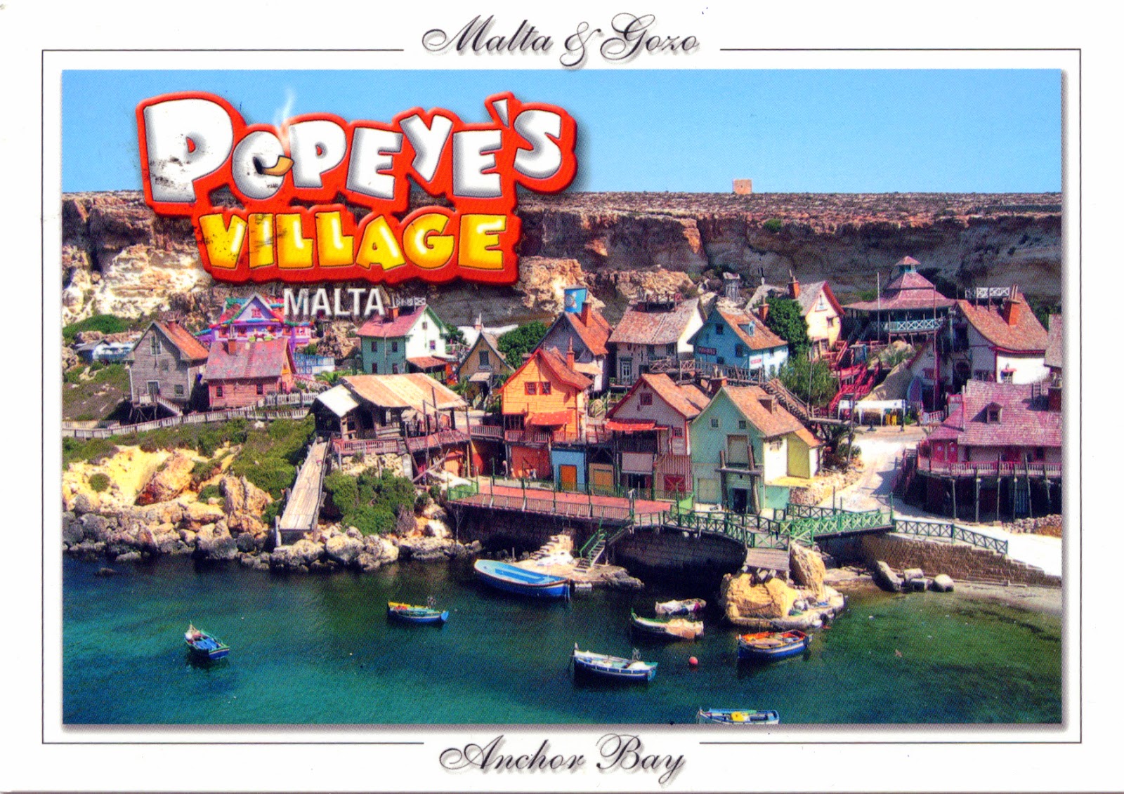
Also known as Sweethaven Village, Popeye Village is a group of rustic and ramshackle wooden buildings located at Anchor Bay, in the north-west corner of the island of Malta, two miles from the village of Mellieħa. It was built as a film set for the production of the 1980 live-action musical feature film Popeye, produced by Paramount Pictures and Walt Disney Productions and starring Robin Williams. Today it is open to the public as an open-air museum and family entertainment complex. Some of the houses in Popeye Village have been equipped with various items related to the filming, including props used in the film's production.

Read more »

1443 FRANCE (French Guiana) - The map of French Guiana

$
0
0

French Guiana is the largest overseas department and region of France, located on the north Atlantic coast of South America, between Brazil and Suriname. Historically speaking, The Guianas (Las Guayanas in spanish) refers to a region in South America, north of the Amazon River and east of the Orinoco River, which includes French Guiana, Guyana (former British Guiana), Suriname (former Dutch Guiana), the Guayana Region in Venezuela (former Spanish Guyana), and Brazilian State of Amapá (former Portuguese Guiana). It consists of two main geographical regions: a coastal strip where the majority of the people live, and dense, near-inaccessible rainforest which gradually rises to the modest peaks of the Tumuc-Humac mountains along the Brazilian frontier.

Read more »

1444 SRI LANKA - Golden Temple of Dambulla (UNESCO WHS)

$
0
0

Situated in the central part of the country, Golden Temple of Dambulla, also known as Dambulla Cave Temple, is the largest and best-preserved cave temple complex in Sri Lanka. There are more than 80 documented caves in the surrounding area, and the rock towers 160 m over the surrounding plains. This temple complex dates back to the 1st century BC, but prehistoric Sri Lankans would have lived in these cave complexes before the arrival of Buddhism in Sri Lanka as there are burial sites about 2700 years old in this area. The larger site incorporates a set of individual units reflecting all phases of site development from the megalithic period to the present day, including a monastic chapter house, bo-tree temple, dagoba and the earliest known village in Sri Lanka. Those are located within a site of considerable natural beauty and power.

Read more »

1445 GAMBIA - "Black Ladies" by Uwe Ommer

$
0
0

Born in 1943 in Bergisch Gladbach (North Rhine-Westphalia, Germany), Uwe Ommer has been taking photos for as long as he can remember. In 1963, he came to live in Paris where he started working as a photographer’s assistant. His work was soon recognized and he began shooting fashion and advertising photos. In December 1995, he took on a personal challenge to make a worldwide family photo album, For four years, he crisscrossed the five continents with his Rolleiflex and his portable studio, creating a unique photographic record of the family at the dawn of the third millennium: 1,251 families photographed and interviewed (1000 Families: das Familienalbum des Planeten Erde / 1000 Families: the Family Album of Planet Earth- Taschen, Cologne, 2000). This postcard, depicting a woman from Gambia, is part of a photo album named Black Ladies(Taco, Berlin, 1987 / Taschen, Cologne, 1995).

Read more »

1446 FRANCE (New Caledonia) - Lagoons of New Caledonia: Reef Diversity and Associated Ecosystems (UNESCO WHS)

$
0
0

Your sumptuous lagoon that the world courts
And your jungle where our first flower was born
Sing in the universe this exquisite romance
Of a victorious island and a triumphant lagoon.

When the nature, inventing a new mode of reproduction, created the first flower, did it in New Caledonia, located back then in the middle of a continent called Gondwana, 130 milion years ago. The chosen plant, Amborella trichopoda, a primitive flower, even today devoid of perfume, is the mother of all the flowers of the planet; she met the dinosaurs. The Caledonian archipelago is a paradise for botanists; it is the third country in the world for its endemic flora; and number one worldwide for biodiversity of plants. As for its lagoon, the largest in the world, ranked among the most beautiful, is one of the three inscribed in humanity's heritage for its richness and exceptional beauty. Feather stars, sea whips, corals, soft corals are also like the flowers. It is the triumph of New Caledonia on land and in the sea.

Read more »

1447 FINLAND (Åland Islands) - The flag of the Åland Islands

$
0
0

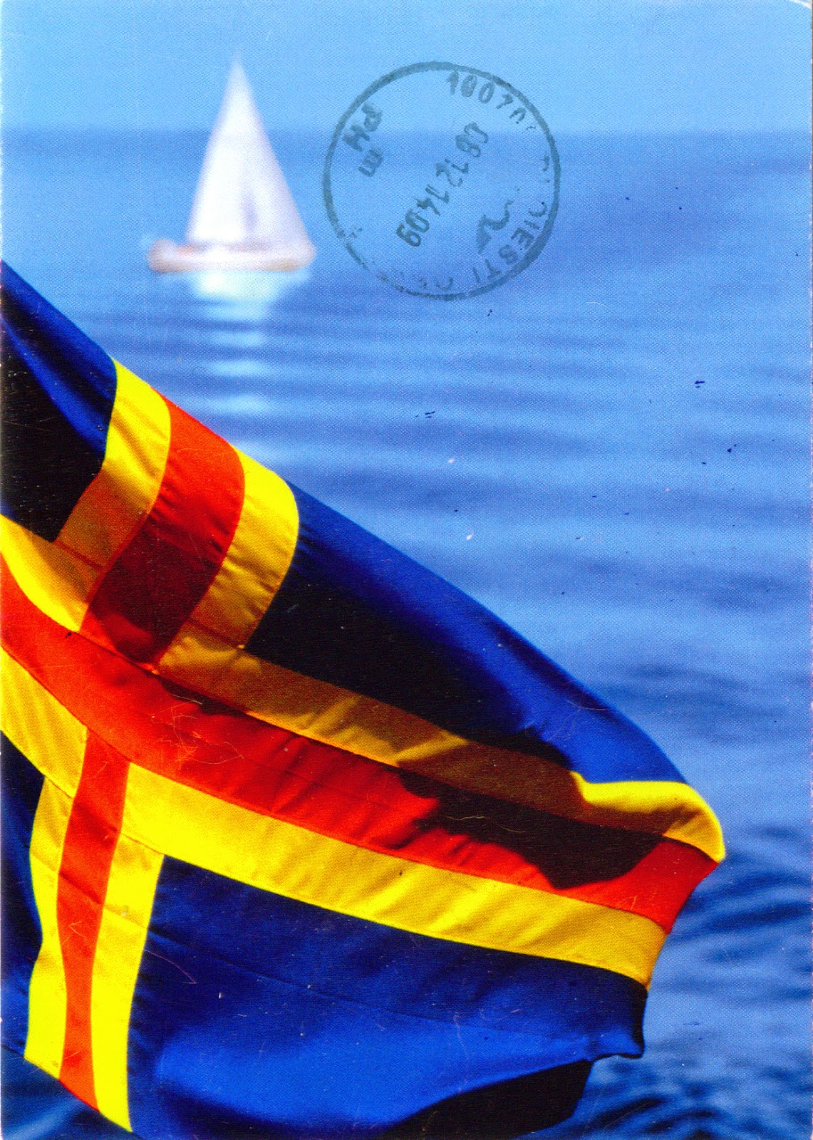
The Åland Islands (Finnish: Ahvenanmaa) is an autonomous region of Finland that consists of an archipelago lying at the entrance to the Gulf of Bothnia in the Baltic Sea, which comprises Fasta Åland (Main Island) and 6,500 skerries and islands. Fasta Åland is separated from the coast of Sweden by 38km of open water to the west, and in the east is contiguous with the Finnish Archipelago Sea. Åland's only land border is located on the uninhabited skerry of Märket, which it shares with Sweden. The archipelago was part of the territory ceded to Russia by Sweden under the Treaty of Fredrikshamn in September 1809. After the Grand Duchy of Finland became the independent Finland in 1917, the islands entered into its composition. Finland declined to cede them, in spite the desire of the inhabitants, almost all Swedish, to unite with Sweden, but a decision made by the League of Nations in 1921, following the Åland crisis, affirmed the autonomous status of the islands.

Read more »

1448 UNITED KINGDOM (Bermuda) - Tobacco Bay

$
0
0

Located in the far north of Bermuda, Tobacco Bay lies close to the town of St. George's and to the historic  Fort St. Catherine. Survivors of Sir George Somers’ ship, the Sea Venture, gave this bay its name after they discovered tobacco growing here. Now, snorkelling is a popular activity, because the bay has impressive underwater coral reefs. It has also an interesting history and was intimately connected with Bermuda's Gunpowder Plot. On August 14, 1775, a group of Bermudians sympathetic to the independentist cause of the American Continental Congress stole gunpowder from the British Magazine in St. George's, rolled it across the island to Tobacco Bay and shipped it to America.

Read more »

1449 GERMANY (Lower Saxony) - Wolfenbüttel Castle

$
0
0

Located on the Oker river, about 13km south of Brunswick, onthe trade routefrom the Rhineto the Elbe, Wolfenbüttel was first mentioned in 1118 (as Wulferisbutle), became the residence of the dukes of Brunswick in 1432, and over the following three centuries it grew to be a centre of the arts. The castle located in the town was destroyed several times, so its appearance changed in time, now  being a real bric-a-brac of different styles. It is not only the second largest of its kind, but it also houses the only ducal apartments in  Lower Saxony dating back to the High Baroque. The still existing magnificent façade and the prestigious apartments built between 1690 and 1740 are a proof of the riches of the ducal court. It had earlier several towers, of which foundations are still partly present today. The highest (Hausmannsturm) was built in 1613 by the royal architect Paul Francke in Renaissance style, and is still standing today.  

Read more »

1450 TAJIKISTAN (Districts of Republican Subordination) - Gissar fortress

$
0
0

Situated at 26 km from Dushanbe, at an altitude of 799-824m, in the center of Gissar valley, the most green and densely-populated part of the country, Gissar fortress is surrounded from all sides by high mountains: from the North - Gissar Range, from the South - the Babatag and Aktau ranges. The fortress has been known for more than 2500 years. As the residence of Gissar bek, the governor-general of the emir of Bukhara, it was an important center of ancient Tajikistan. Time didn't spare the fortress and its structures. In the old days it had walls of 1 meter thick, loopholes for guns and cannons, a pool and a garden inside. The only thing that remained is a monumental gateway with two cylindrical towers, between which there is an ogival arch, built in the 16th century. Besides the castle there are two huge plane trees, which are about 500-700 years old.

Read more »
1451 A world map

$
0
0

I like this map, but I don't know what can I say about it. It was printed in Russia... Otherwise... Ah, it is deformed in an unusual way... Any map is distorted, because it's a problem to represent a globe on a plane, but this map has a disproportionate ratio between water and land, i.e. that the seas and oceans occupy an area much smaller than in reality. But who cares? There is no one going to be guided by such a map. In another train of thoughts, the fantastic animals present on the maps of the great geographical discoveries era were replaced, in a cute way, with childish representations of animals common in cartoons.

Read more »

1452 NORWAY (Svalbard) - An aurora borealis seen from Svalbard archipelago

$
0
0

Nature gives us a lot of amazing performances, but none is so impressive, mysterious and beautiful as the aurora, a show of light and color that can be seen on the sky of the Arctic and Antarctic regions. Those who lived this experience say it can't be compared with anything in the world, and the photos seem to give them right. Scientifically speaking, an aurora is a natural light display in the sky, caused by charged particles, mainly electrons and protons, entering the atmosphere from above causing ionisation and excitation of atmospheric constituents, and consequent optical emissions. When it occurs in the northern hemisphere (from September to October, and from March to April), the phenomenon is known as the aurora borealis (or the northern lights), a term originally used by Galileo Galilei, referring to the Roman goddess of dawn, Aurora, and to the Titan who represent the winds, Boreas.

Read more »

1453 GUINEA (Faranah) - Kissi woman with a djabara

$
0
0
 

Kissi people live in Guinea (420,000), Liberia (176,000) and Sierra Leone (125,000), speak a Niger–Congo language, and are well known for making baskets and weaving on vertical looms, although are primarily farmers. In past times they were also famous for their iron working skills, the Kissi smiths producing the famous Kissi penny, an iron money widely used in West and even Central Africa. They live in small, self-governing villages that are tucked inside groves of mango or kola trees. Each village is compact, containing no more than about 150 people. Although they have converted to Christianity, most of them continue to practice their traditional ethnic religion. Ancestor worship or praying to deceased relatives is a common practice among the Kissi.

Read more »
Viewing all 2426 articles
Browse latest View live