Quantcast
Channel: WORLD, COME TO MY HOME!
Viewing all 2426 articles
Browse latest View live

1060 UNITED STATES (Pennsylvania) - The map of Commonwealth of Pennsylvania

$
0
0

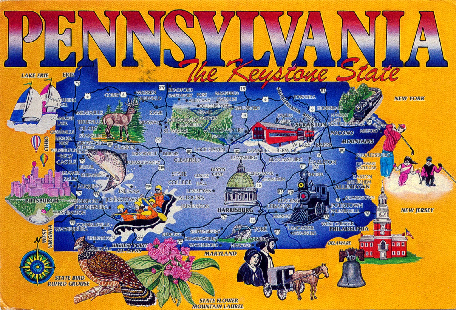
Located in the Great Lakes region, between Delaware, Maryland, West Virginia, Ohio, Lake Erie and Ontario, the Canadian province of Ontario, New York and New Jersey, Pennsylvania is one of the 13 original founding states of the United States. Its nickname, the Keystone State, derives from the fact that it forms a geographic bridge both between the Northeastern states and the Southern states, and between the Atlantic seaboard and the Midwest. It is bisected diagonally by ridges of the Appalachian Mountains. To the northwest is the Allegheny Plateau, underlain by sedimentary rocks of Mississippian and Pennsylvanian age, which bear natural gas and petroleum. In 1859, near Titusville, was drilled the first oil well in the U.S. into these sediments. Timber and dairy farming are also sources of livelihood for Pennsylvania. Along the shore of Lake Erie in the far northwest are orchards and vineyards. The state bird is Ruffed Grouse, the state flower is Mountain Laurel, and its motto is "Virtue, liberty, and independence".

Read more »

1061 CHINA (Guizhou) - Long Skirt Miao women

$
0
0

Miao is an ethnic group who live primarily in southern China, in the provinces of Guizhou, Hunan, Yunnan, Sichuan, Guangxi, Hainan, Guangdong, and Hubei, but also, in smaller numbers, in northern Vietnam, Laos, Myanmar and Thailand, and even in several Western countries, mainly in the United States, France, and Australia. Miao is actually the official Chinese term for four distinct groups of people who are only distantly related through language or culture (and doesn't reflect the self-designations of the component nations of people): the Hmu people of southeast Guizhou, the Kho (Qho) Xiong people of west Hunan, the A-Hmao people of Yunnan, and the Hmong people of Guizhou, Sichuan, Guangxi, and Yunnan. There are some nine million Miao in China, of whom the Hmong constitute probably one-third. The Miao are related in language and some other cultural features to the Yao; among these peoples the two groups with the closest degree of relatedness are the Hmong (Miao) and the Iu Mien (Yao).

Read more »

1012, 1062 UNITED STATES (Texas) - The map and the flag of State of Texas

$
0
0

Posted on 23.02.2014, 22.04.2014
Located in the Gulf of Mexico, at the border with Mexico, between New Mexico, Oklahoma, Arkansas, and Louisiana, Texas is the second most populous (after California) and the second-largest of the 50 states (after Alaska) of the United States. In Pre-Columbian period, in the area were developed three major indigenous cultures, which reached their developmental peak before the first European contact: the Pueblo, the Mississippian culture, and the civilizations of Mesoamerica. In 1528, after the arrival of Álvar Núñez Cabeza de Vaca, "half the natives died from a disease of the bowels". During the next 150 years Europeans have ignored the area, then occupied by French (1684-1689), Spanish(1690-1821), and Mexican (1821-1836). Becoming republic after the Declarationof Independence in 1836, it was admitted to the Unionas the 28th state in 1845, and during the Civil War joined the ConfederateStates.

Although Texas is popularly associated with the Southwestern deserts, less than 10 percent of its land area is desert. Almost twice as large as Germany, Texas has four major physical regions: GulfCoastal Plains (covered by thick piney woods), Interior Lowlands, Great Plains(dominated by prairie and steppe), and Basin and Range Province. Most of the population centers are located in areas of former prairies, grasslands, forests, and the coastline. Three of its borders are defined by rivers: Rio Grande (with Mexico), Red River (with Oklahoma and Arkansas), and Sabine River (with Louisiana). Its large size and its location at the intersection of multiple climate zones gives it highly variable weather. Some of the most destructive hurricanes in U.S. history have impacted Texas.


Texas's large population, abundance of natural resources, thriving cities and leading centers of higher education have contributed to a large and diverse economy, even if since the discovery of the oil, the state's economy has reflected the state of the petroleum industry. In 2010, there were 346,000 millionaires in Texas, which has the second highest gross state product (GSP) in the U.S., comparable to the GDP of India or Canada. Its largest city is Houston, the fourth-largest in the U.S., but the state capital is Austin. The origin of the state name is from the word tejas, which means 'friends' in the Caddo language. It is nicknamed the Lone Star State, to signify it as a former independent republic and as a reminder of the state's struggle for independence from Mexico.

The flag of the state, adopted in 1839, is a rectangle that has a width to length ratio of two to three and contains one blue vertical stripe that has a width equal to one-third the length of the flag, two equal horizontal stripes, white and red, and one white, regular five-pointed star (the Lone Star) located in the center of the blue stripe, oriented so that one point faces upward. The blue symbolise loyalty, the white purity, and the red bravery. The Seal of the state was adopted in 1845, and consists of a star of five points, encircled by olive and live oak branches, and the words, "The State of Texas." The state bird is Mockingbird, the three - pecan, and the flower - bluebonnet.

Read more »
1063 MEXICO (Oaxaca) - Historic Centre of Oaxaca and Archaeological Site of Monte Albán (UNESCO WHS)

$
0
0

This World Heritage property, located in the central valleys of Oaxaca, in the depression formed between the Sierra Madre Oriental and the Sierra Madre del Sur, is composed of two distinct cultural sites: the historic centre of Oaxaca de Juarez (a good example of Spanish colonial town planning) and the pre-Columbian archaeological site of Monte Albán, consisting of terraces, dams, canals, pyramids and artificial mounds carved out of the mountain, the symbols of a sacred topography. Inhabited over a period of 1,500 years by a succession of peoples (Olmecs, Zapotecs and Mixtecs), the site is known for its unique dimensions which exhibit the basic chronology and artistic style of the region and for the remains of magnificent temples, ball court, tombs and bas-reliefs with hieroglyphic inscriptions.

Read more »

1064 SPAIN (Cantabria) - Suances

$
0
0

Suances extends around the union of the rivers Saja and Besaya, forming at its mouth the estuary of Suances, also known as San Martin de la Arena. The estuary forms a natural harbor between cliffs (Punta del Dichoso) in which many historians locate the Portus Blendium, a Roman port famous for its navy and great commercial, which became the most important route of entry of the Cantabrian coast. Their rocky creeks and their extensive sandbanks, as also the succession of smooth hills and valleys which forms the beautiful places crossed by the confluence of the two rivers, are some of the attractiveness of the municipality.

Read more »

1067-1070 UNITED STATES (New York) - Statue of Liberty (UNESCO WHS)

$
0
0

The Statue of Liberty (Liberty Enlightening the World) is a colossal neoclassical sculpture on Liberty Island in the middle of New York Harbor, in Manhattan, New York City. The statue, designed by Frédéric Auguste Bartholdi and dedicated on October 28, 1886, was a gift to the United States from the people of France. The statue is of a robed female figure representing Libertas, the Roman goddess of freedom, who bears a torch and a tabula ansata (a tablet evoking the law) upon which is inscribed the date of the American Declaration of Independence, July 4, 1776. A broken chain lies at her feet. The statue is an icon of freedom and of the United States: a welcoming signal to immigrants arriving from abroad.


This masterpiece of the human spirit, which brings together art and engineering in a new and powerful way, is composed of thinly pounded copper sheets over a steel framework, designed by the French engineer Gustave Eiffel. Its symbolic value lies in two basic factors. It was presented by France with the intention of affirming the historical alliance between the two nations. It was financed by international subscription in recognition of the establishment of the principles of freedom and democracy. The Statue also soon became and has endured as a symbol of the migration of people from many countries into the United States in the late 19th and the early 20th centuries.


The torch-bearing arm was displayed at the Centennial Exposition in Philadelphia, in 1876, and in New York's Madison Square Park from 1876 to 1882. Fundraising proved difficult, especially for the Americans, and by 1885 work on the pedestal was threatened due to lack of funds. Publisher Joseph Pulitzer of the New York World started a drive for donations to complete the project that attracted more than 120,000 contributors, most of whom gave less than a dollar. The statue was constructed in France, shipped overseas in crates, and assembled on the completed pedestal on what was then called Bedloe's Island. The statue's completion was marked by New York's first ticker-tape parade and a dedication ceremony presided over by President Grover Cleveland.


In 1956, Bedloe's Island was renamed Liberty Island, and nearby Ellis Island was made part of the Statue of Liberty National Monument by proclamation of President Lyndon Johnson in 1965. In 1972, the American Museum of Immigration, in the statue's base, was opened in a ceremony led by President Richard Nixon. The museum's backers never provided it with an endowment to secure its future and it closed in 1991 after the opening of an immigration museum on Ellis Island.

Read more »

1071 MONGOLIA - A child jockey to a horse racing

$
0
0

Nowhere are horses more central to daily life than in Mongolia. Mongolia is known as the land of the horse, and Mongols have a reputation for being the best horsemen on Earth. Over the centuries, using chariots as well as mounted warriors, nomadic armies of Mongols struck south of the Great Wall and into the heart of Europe. The legendary thirteenth-century warrior Genghis Khan established an empire that extended from Hungary to Korea and from Siberia to Tibet. Known in Europe as “Hell’s Horsemen,” Mongols could ride up to 80 miles a day, across deserts and mountains considered - until the arrival of these mounted armies - to be impassable.

Read more »

1072 UNITED STATES (West Virginia) - The map of State of West Virginia

$
0
0

Bordered by Virginia, Kentucky, Ohio, Pennsylvania, and Maryland, West Virginia is located in the Appalachian Mountains, being nicknamed The Mountain State and having the motto Montani Semper Liberi (Mountaineers are always free). The capital and largest city is Charleston, founded at the end of the 18th century. Natural resources, such as salt, coal and later natural gas contributed to the growth of the city. West Virginia became a state following the Wheeling Conventions, in which 50 northwestern counties of Virginia whose landowners owned few to no slaves decided to break away from Virginia during the American Civil War, being the only one which was formed by seceding from a Confederate state. The new state was admitted to the Union on June 20, 1863, and was a key Civil War border state.

Read more »

1073 CROATIA (Lika-Senj) - Plitvice Lakes National Park (UNESCO WHS)

$
0
0

Situated in the mountainous karst area of central Croatia, at the border to Bosnia and Herzegovina, Plitvice Lakes National Park is the oldest national park in Southeast Europe and the largest national park in country. It is famous for the 16 lakes arranged in cascades between Mala Kapela Mountain and Pljesevica Mountain, a result of the confluence of several small rivers and subterranean karst rivers. The lakes are all interconnected and follow the water flow, being separated by natural dams of travertine, which is deposited by the action of moss, algae, and bacteria. The encrusted plants and bacteria accumulate on top of each other, forming travertine barriers which grow at the rate of about 1cm per year.

Read more »

1074 UNITED ARAB EMIRATES (Dubai) - Razafat and yula dance

$
0
0

The United Arab Emirates is a part of the Arab khaleeji tradition (characterized by heavy use of the oud and tabl drum), and is also known for Bedouin folk music. Many of the songs and dances, handed down from generation to generation, have survived, even if today only 16.5% of the country's population are Emiratis, mainly originating from the Bani Yas tribe or with Persian origins (Sunni and Shia). The interpretation of these folk arts varies between the coast, the oases and the desert, but the structure is broadly similar and the common themes are pride, religion, praise, masculinity, strength and chivalry.

Read more »

1075 FINLAND - A Finnish folk dance group in Glims Farmstead Museum in Espoo

$
0
0

As in many of the european countries, the Finnish national costumes are based on the outfits of common people in the end of the 17th and the beginning of the 18th century. These outfits used to represent the estate of the wearer, so even there were dressing laws which forbade dressing too sophisticated for the ones who weren't in upper class. Common people therefore had to come up with ways to dress well without breaking the laws. These laws influenced a lot the dressing of common people and the way the Finnish national costumes look today. As the dialects of Finnish language, also the Finnish folk costumes are divided in two groups, namely western, and Karelian, or eastern.

Read more »

1076 LEBANON - Baalbek (UNESCO WHS)

$
0
0

Situated east of the Litani River, in the Beqaa Valley, at the foot of the south-west slope of Anti-Lebanon, Baalbek, founded by Phoenicians and known as Heliopolis (in Greek, the City of the Sun) during the period of Roman rule, was one of the largest sanctuaries in the empire. The importance of this amalgam of ruins of the Greco-Roman period with even more ancient vestiges of Phoenician tradition, are based on its outstanding artistic and architectural value. The Roman construction was built on top of earlier ruins which were formed into a raised plaza, formed of 24 monoliths, the largest  weighing over 800 tons. The gods that were worshipped at the temple - Jupiter, Venus, and Bacchus - were grafted onto the indigenous deities of Hadad, Atargatis, and a young male god of fertility. Local influences are seen in the planning and layout of the temples, which vary from the classic Roman design.

Read more »

1077-1078 BOSNIA AND HERZEGOVINA - Bosnian Serbs in the ethno village Stanišići

$
0
0

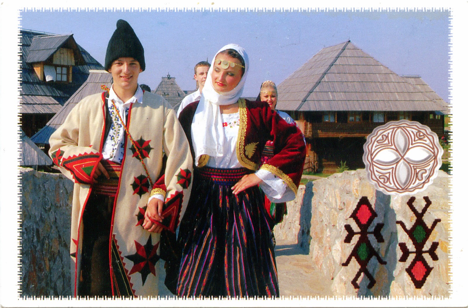
Bosnia and Herzegovina is home to three ethnic "constituent peoples", Bosniaks, Serbs and Croats, all three explicitly mentioned in the constitution, none of them being considered a minority or immigrant. The costumes of Bosnian Serbs are divided into two groups, the Dinaric and Pannonian styles. The basic element of both women's and men's dress was a hemp or linen shirt in the form of a tunic with sleeves, abundantly decorated with embroidery done in yarn. The Jelek is a Waistcoat made from wool or velvet while women's jackets are lined with fur. The peony embroidery design often found on aprons, socks and elsewhere is colored bright red, symbolising the blood lost at the Battle of Kosovo.


Traditional Serbian female costume consists of Opanci, embroidered woolen socks that reached to the knees and Nazuvice. Skirts are very varied, of plaited or gathered and embroidered linen, with tkanice serving as a belt. An important part of the costume are aprons (Pregace) decorated with floral motifs. Scarves bordered with cords were worn as headdress. Girls also wear collars, or a string of gold coins around their throats, earrings, bracelets, and their caps were decorated with metal coins. The men wear in the winter Šubara, a fur hat in a conical or cylindrical shape,  predominantly black, because of the black lamb/sheep fur (woolen).

Read more »

1079 ARMENIA - The monastery of Noravank and the upper Amaghou Valley (UNESCO WHS - Tentative List)

$
0
0

The armenian architecture developed over the last 4,500 years of habitation in the Armenian Highland (the eastern part of Asia Minor), but its greatest achievement are the medieval churches (let us not forget that Armenia was the first nation to adopt Christianity as a state religion, an event traditionally dated to AD 301.). This country has abundant resources of stone, and relatively few forests, so stone was nearly always used throughout for large buildings. In addition, the region being prone to earthquakes, the buildings were erected with this hazard in mind, resulting sturdy, low-slung and thick-walled structures. Even if many relics of Armenia's past, such as churches, cemeteries and khachkars, have been subject to devastation as a result of Anti-Armenianism, some of them survived, several being included among UNESCO World Heritage Sites, and others being proposed in Tentative List.

Read more »

1080 NETHERLAND (North Holland) - IJmuiden North Breakwater Light

$
0
0

Located at the mouth of the North Sea Canal to Amsterdam, approximately 17km north of Haarlem, IJmuiden (mouth of the IJ) is an important port city, its port being the third of the Netherlands. Before the building of present IJmuiden, the area (known as Breesaap) was a desolate plain, where only a handful of farmers strove to make a living. Plans to connect Amsterdam with a canal to the North Sea, with its mouth in this area, had been drawn up since 1626, but were only set into motion in the 19th century. So IJmuiden is the newest city in North Holland, and only came into existence on November 1, 1876, when the North Sea Canal was officially opened by William III of the Netherlands. Of course that on the pier are several lighthouses, among which the one in the postcard, located on the north side. Build on 1970s from concrete, it has 40m height, and is visible for 10 nautical miles.

Read more »

1081-1082 BERMUDA - The map of the archipelago

$
0
0

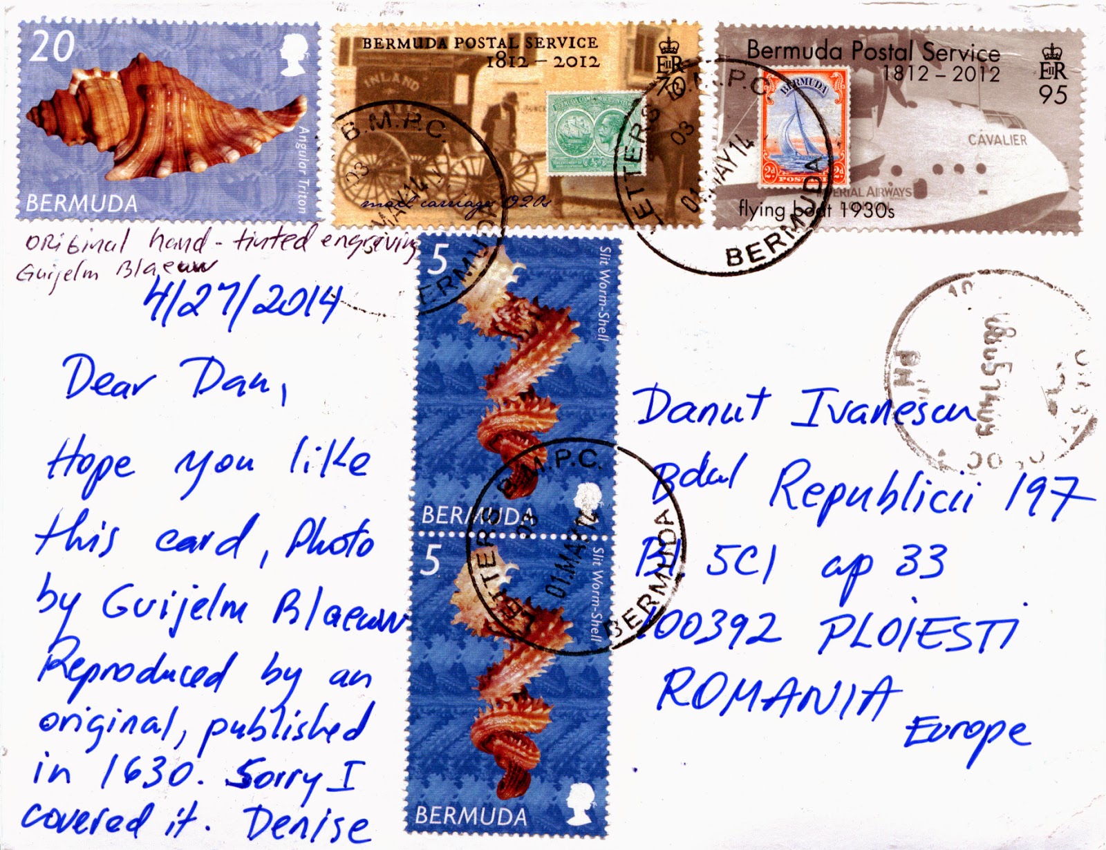
Bermuda is a group of low-forming islands (181, the largest being Main Island) located in the North Atlantic Ocean, at about 1,030km from Cape Hatteras (North Carolina), near the western edge of the Sargasso Sea. It is the northernmost point of the so-called Bermuda Triangle, a region of sea in which, according to legend, a number of aircraft and surface vessels have disappeared under supposedly unexplained or mysterious circumstances. The archipelago is formed by high points on the rim of the caldera of a submarine volcano. The top of the seamount has gone through periods of complete submergence, during which its limestone cap was formed by marine organisms, and during the Ice Ages the entire caldera was above sea level.  Bermuda has a humid subtropical climate, on the border of tropical climate, and is within the hurricane belt, the only source of fresh water being rainfall. Its economy is based on offshore insurance and reinsurance, and tourism. Bermuda's pink sand beaches and clear, cerulean blue ocean waters are popular with tourists.


Bermuda was discovered in 1503 by Spanish explorer Juan de Bermúdez, after whom the islands are named. He claimed the apparently uninhabited islands for the Spanish Empire. In 1609, the English Virginia Company, which had established Virginia and Jamestown on the North American continent two years earlier, established a settlement. The islands became a British colony following the 1707 unification of the parliaments of Scotland and England, which created the Kingdom of Great Britain. Its first capital, St. George's (originally called New London), was established in 1612 and is the oldest continuously inhabited English town in the New World. At the begining of the American War of Independence, Bermuda supported the rebels, but the economic realities caused Bermudians to seize opportunities; they turned to privateering against the Americans. Following the war, with the buildup of Naval and military forces in Bermuda, the primary leg of the Bermudian economy became defence infrastructure. Even after tourism began later in the 19th century, Bermuda remained, in the eyes of London, a base more than a colony.

Read more »

1083 FINLAND (Northern Ostrobothnia) - Wooden Church in Vihanti

$
0
0

Located in the centre of Finland, Vihanti is a little town, which has only 3000 inhabitants, even after the assimilation of the neighbor city of Raahe in 2013. The wooden church in the postcard was built during the reign of Gustav III of Sweden, and was named after the wife of the king, Sophia Magdalena. Its building was decided in 1871, after an inspection which found that the old church, built in 1691, couldn't be extended. The plans was made by Simon Silvén, and the church was completed in June 1784. The bell tower of the old church has been preserved and it is one built in 1752. The interior was decorated by Emanuel Granberg and Erik Westzynthius, and the altarpiece was painted directly to the log wall. 

Read more »

1084 SPAIN (Galicia) - Tower of Hercules (UNESCO WHS)

$
0
0

Located on a promontory in the entrance of an estuary in a large gulf (the Portus Magnus Artabrorum of the classical geographers) on the Atlantic Ocean, A Coruña served as political capital of the Kingdom of Galicia from the 16th to the 19th centuries, and as a regional administrative centre between 1833 and 1982, before being replaced by Santiago de Compostela. The city is the site of the Roman Tower of Hercules, a lighthouse which has been in continuous operation since possibly the 2nd century AD, reason for what was declared by UNESCO as a World Heritage Site. According to a myth, the hero Hercules slew the giant tyrant Geryon after three days and three nights of continuous battle. Hercules then buried the head of Geryon with his weapons and ordered that a city be built on the site. The lighthouse atop a skull and crossbones representing the buried head of Hercules’ slain enemy appears in the coat-of-arms of the city of  A Coruña.

Read more »

1085 BERMUDA - Gombeys

$
0
0

The Gombey is an iconic symbol of Bermuda, this folklife tradition reflecting the island’s blend of African, indigenous peoples, Caribbean and British cultures, incorporating them over time into a unique performance art full of colorful and intricate masquerade, dance and drumming. The word "Gombey" is related to the Bahamian "Goombay", a similar dance tradition. It also refers to a specific drum of African origin. Dancers are usually male, and perform in groups of 10-30 though in modern times female groups have emerged. The traditions have been passed down orally from one generation to the next within families and the Captains of each troupe determine the direction of the troupe and style that is taught.

Read more »

1086 NETHERLANDS (Drenthe) - A dolmen in Drenthe

$
0
0

Located in the northeast of the Netherlands, the province Drenthe is a sparsely populated rural area, its land being mainly used for agriculture. It has been populated by people since prehistory, the artifacts from the Wolstonian Stage (150.000 years ago) being among the oldest found in the Netherlands. In fact, it was one of the most densely populated areas of the Netherlands until the Bronze Age. Most tangible evidence of this are the dolmens (hunebedden) built in the middle of the Stone Age (in the Neolithic Era, 3400-2850 BC); 52 of the 54 dolmens in the Netherlands can be found in Drenthe, concentrated in the northeast of the province.

Read more »
Viewing all 2426 articles
Browse latest View live