Quantcast
Channel: WORLD, COME TO MY HOME!
Viewing all 2426 articles
Browse latest View live

0205, 1476 RUSSIA (Altai Republic) - Golden Mountains of Altai (UNESCO WHS)

$
0
0
0205 - The Argamdzi River in Ukok Quiet Zone

Posted on 13.05.2012, and 05.03.2015
In nowadays, the specially protected territories and natural complexes with an area of almost 22% of the whole Republic's territory are distinguished in the Altai Republic, which has an area of 92,600km2 and is situated in the very center of Asia, at the junction of Siberian taiga, steppes of Kazakhstan and semi-deserts of Mongolia. In 1998, UNESCO included on its list of World Heritage Sites Golden Mountains of Altai, consisting of three separate areas: Altaisky Zapovednik and a buffer zone around Lake Teletskoye; Katunsky Zapovednik and a buffer zone around Mount Belukha; and the Ukok Quiet Zone on the Ukok plateau. "The region represents the most complete sequence of altitudinal vegetation zones in central Siberia, from steppe, forest-steppe, mixed forest, subalpine vegetation to alpine vegetation. The site is also an important habitat for endangered animal species such as the snow leopard."

1476 - Belukha Mountain

The Ukok Quiet Zone is located in the south-east of the Altai Republic, near the borders with China, Kazakhstan and Mongolia, on a high mountain plateau dominated by hills and steppe landscapes with marsh, streams and lakes, which have particular cultural and religious values for local people. It is a remote and pristine grasslands area, once inhabited by the Pazyryk, an ancient people who are associated with some spectacular archeological findings, including mummies found frozen in the permafrost. Currently the region is threatened by two major russian projects: a gas pipeline, which will be constructed from western Siberia to China’s Xinjiang Province, and a large dam that would block the wild and untamed Katun River.

Read more »

1477 CHAD (Ennedi) - Lakes of Ounianga - Lake Téli (UNESCO WHS)

$
0
0

Lakes of Ounianga are a series of 18 interconnected lakes in the Sahara Desert, in North-Eastern Chad, occupying a basin in the mountains of West Tibesti and Ennedi East. It constitutes an exceptional natural landscape of great beauty with striking colours and shapes. The saline, hyper saline and freshwater lakes are supplied by groundwater and are found in two groups 40km apart. Ounianga Kebir (The Great Ounianga) comprises 4 lakes, the largest being Yoan. Its highly saline waters only sustain algae and some microorganisms. The second group, Ounianga Serir (The Little Ounianga), comprises 14 lakes separated by sand dunes. With their high quality freshwater, some of these lakes are home to aquatic fauna, particularly fish. At 436 ha, Lake Téli has the largest surface area but is less than 10m deep.

Read more »

1244, 1478 BRUNEI - Sultan Omar Ali Saifuddin Mosque

$
0
0
1244 - Sultan Omar Ali Saifuddin Mosque

Posted on 24.09.2014 and 07.03.2015
Built on an artificial lagoon on the banks of the river Brunei, Sultan Omar Ali Saifuddin Mosque dominates not only so-called village in the water, Kampong Ayer, but even the skyline of  Bandar Seri Begawan, the capital of the sultanat. The mosque initially seems more attraction than place of worship. However, this could not be farthest from the truth, and the grandiose mosque was in fact designed solely for prayer to Allah. Completed in 1958 and named after Omar Ali Saifuddien III, the 28th Sultan of Brunei who also initiated its construction, the mosque serves as a symbol of the Islamic faith in Brunei, the official religion of the state. Formally, the freedom of religion is guaranteed, but more recently the Sultan has announced strict penalties for those who leave Islam.

1478 - Sultan Omar Ali Saifuddin Mosque

The mosque, the largest in the Far East, is an example of modern Islamic architecture, uniting Mughal architecture and Italian styles. The design was done by A.O.Coltman of the firm Booty and Edwards Chartered Architects, who were based in Kuala Lumpur, Malaysia at that time. It has marble minarets and domes covered in pure gold, a courtyard and is surrounded by a large number of trees and floral gardens. A bridge reaches across the lagoon to Kampong Ayer in the middle of the river. Another marble bridge leads to a structure in the lagoon meant as a replica of a 16th Century Sultan Bolkiah Mahligai Barge. The barge itself was completed in 1967 to commemorate the 1,400th anniversary of Nuzul Al-Quran (coming down of the Quran) and was used to stage the Quran reading competitions.

Read more »

1479 UNITED STATES (Virginia) - The map of the Commonwealth of Virginia

$
0
0

Bordered by Maryland and Washington, D.C. to the north and east; by the Atlantic Ocean to the east, by North Carolina and  Tennessee to the south, Virginia is nicknamed the "Old Dominion" due to its status as a former dominion of the English Crown, and "Mother of Presidents" due to the many U.S. presidents having been born there. Its geography and climate are shaped by the Blue Ridge Mountains and the Chesapeake Bay, which provide habitat for much of its flora and fauna. Many of Virginia's rivers flow into the Chesapeake Bay, including the Potomac, Rappahannock, York, and James, which create three peninsulas in the bay. The Blue Ridge Mountains are a physiographic province of the Appalachian Mountains with the highest points in the state, the tallest being Mount Rogers at 1,746 m.

Read more »

1480-1482 ROMANIA (Prahova) - Peleş Castle

$
0
0
1480 - Peleş Castle seen from helicopter

In 1866, just months after he ascended the throne of Romanian Principalities (formed by only 7 years, by the unification of Wallachia and Moldavia, then still under the suzerainty of the Ottoman Empire), Carol I visited Sinaia, at that time a small village called Podul Neagului (Neagu's Bridge), and fell in love with the magnificent mountain scenery. Prince decides building a castle in a secluded and picturesque place: Piatra Arsă (The Burnt Stone). In 1872, the Crown purchased 10km2 of land and commissioned the construction of a royal hunting preserve and summer residence. The first three design plans were copies of other palaces in Western Europe, and Carol I rejected them. The german architect Johannes Schultz won the project with a plan representing a grand palatial alpine villa, combining different features of classic European styles, mostly following Italian elegance and German aesthetics.

1481 - Peleş Castle - detail

In 1875 was laid the foundation stone of the Peleş Castle, in which are buried dozens of gold coins of 20 lei, the first Romanian coins with the image of Carol I. Works were also lead by architect Carol Benesch. Queen Elisabeth of Romania, during the construction phase, wrote in her journal: "Italians were masons, Romanians were building terraces, the Gypsies were coolies. Albanians and Greeks worked in stone, Germans and Hungarians were carpenters. Turks were burning brick. Engineers were Polish and the stone carvers were Czech. The Frenchmen were drawing, the Englishmen were measuring, and so was then when you could see hundreds of national costumes and fourteen languages in which they spoke, sang, cursed and quarreled in all dialects and tones, a joyful mix of men, horses, cart oxen and domestic buffaloes."

1482 - Peleş Castle - Sala Mare De Arme (The Grand Armory)

Construction saw a slight slowdown during the Romanian War of Independence against the Ottoman Empire in 1877-1878, but in 1883 held the official opening of the castle. Meanwhile, in 1881 the Romanian Principalities became the Kingdom of Romania, and Carol I was crowned as King. Later additions to Peleş Castel were made between 1893 and 1914 (the year of the death of King Carol I) by the Czech architect Karel Liman, who designed the towers, including the main central tower, which is 66m in height. By form and function, Peleş is a palace, but it is consistently called a castle. Its architectural style is a romantically inspired blend Neo-Renaissance and Gothic Revival similar to Schloss Neuschwanstein in Bavaria. A Saxon influence can be observed in the interior courtyard facades. Interior decoration is mostly Baroque influenced, with heavy carved woods and exquisite fabrics.

Read more »

1483 UNITED KINGDOM (Bermuda) - Heydon Trust Chapel

$
0
0

In western Sandys parish is a private park, a beautiful property administered by the Heydon Trust. This 43 acres of lush gardens is one of the largest parks in Bermuda and also has 10 old buildings in it. There is also a chapel called Heydon Chapel, the smallest church in Bermuda, built in the early 1600s. This property was donated by Mr. & Mrs. Bernard Matthews, members of the Church of England. The gardener is the only person who draws pay from the trustees, everyone else working or contributing to the maintenance of this park doing it by voluntary services. The name of the Park came from Jeremy Heydon, an investor in the Bermuda Company that used to run the governance of Bermuda in the early 17th century.

Read more »

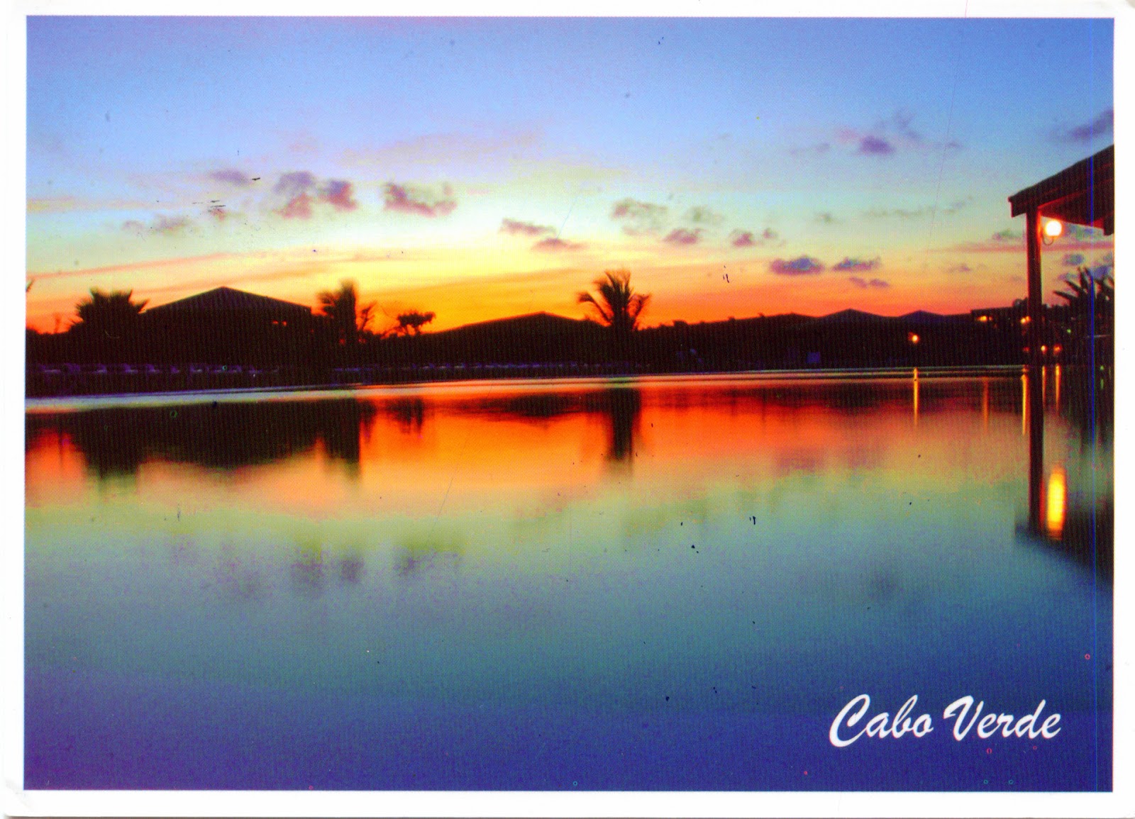
1484 CAPE VERDE - The coast at sunset

$
0
0

Tourism in Cape Verde, started in the 1970s on the island Sal and increased slowly in the 1980s and 1990s. The number of tourists increased from approximately 45,000 in 1997 to more than 552,144 in 2013. The vast majority of tourists visit the comparatively flat and scarcely populated islands of Boa Vista, Sal, and Maio with their white sandy beaches. The islands of Cape Verde have a pleasant climate during most of the year with 350 days of sunshine, and some of them offer an impressive mountain scenery as well. Some ecotourism is developing on the island of Fogo around the volcano Pico do Fogo. It should be noted that Cape Verde has won a positive reputation in promoting what is considered the most stable democracy in Africa, a standard of living higher than most African nations, and one of the most politically liberal nations on the continent, and in the world.

Read more »

1485 THAILAND (Bangkok) - The Royal Barge Chanting Ceremony

$
0
0
The Royal Barge Chanting Ceremony
Narai Song Suban Ratchakan Thi Kao


The Royal Barge Procession is a ceremony of both religious and royal significance which has been taking place for nearly 700 years. It takes place rarely, typically coinciding with only the most significant cultural and religious events. For example, during the reign of King Bhumibol Adulyadej, spanning over 60 years, the Procession has only occurred 16 times. It most likely began during the Ayutthaya period in the 14th century. Western visitors witnessed and wrote about the "immense procession with 200 boats" upon their arrival in Thailand in the 18th century. During the processions, the oarsmen were kept in rhythm by the beating of drums, with accompanying music. This traditional boat song was written by Prince Dhamma Dibes of the late Ayutthaya period.

Read more »

1487 ABKHAZIA - Pitsunda, the kingdom of the sea and pines

$
0
0

Located in South Caucasus, on the north shore of the Black Sea, on the western end of Georgia, Abkhazia has a varied topography, from the ranges from the lowlands around the sea to the high peaks of the Caucasus Mountains in the north, but however the region is mainly mountainous and settlement is largely confined to the coast and a number of deep, well-watered valleys. One of the mountains range is Gagra Range, which runs between the valleys of the Bzyb and Psou rivers to the south of the Caucasus Major. It approaches to the Black Sea close to the city of Gagra and plays an important role in moderating the climate of that resort by blocking cold, continental winds from the north and east.

Read more »

1012, 1062, 1488 UNITED STATES (Texas) - The map and the flag of State of Texas

$
0
0
1012 - The map and the flag of State of Texas 

Posted on 23.02.2014, 22.04.2014, and 15.03.2015
Located in the Gulf of Mexico, at the border with Mexico, between New Mexico, Oklahoma, Arkansas, and Louisiana, Texas is the second most populous (after California) and the second-largest of the 50 states (after Alaska) of the United States. In Pre-Columbian period, in the area were developed three major indigenous cultures, which reached their developmental peak before the first European contact: the Pueblo, the Mississippian culture, and the civilizations of Mesoamerica. In 1528, after the arrival of Álvar Núñez Cabeza de Vaca, "half the natives died from a disease of the bowels". During the next 150 years Europeans have ignored the area, then occupied by French (1684-1689), Spanish(1690-1821), and Mexican (1821-1836). Becoming republic after the Declarationof Independence in 1836, it was admitted to the Unionas the 28th state in 1845, and during the Civil War joined the ConfederateStates.

1488 - The flag of State of Texas
 

Although Texas is popularly associated with the Southwestern deserts, less than 10 percent of its land area is desert. Almost twice as large as Germany, Texas has four major physical regions: GulfCoastal Plains (covered by thick piney woods), Interior Lowlands, Great Plains(dominated by prairie and steppe), and Basin and Range Province. Most of the population centers are located in areas of former prairies, grasslands, forests, and the coastline. Three of its borders are defined by rivers: Rio Grande (with Mexico), Red River (with Oklahoma and Arkansas), and Sabine River (with Louisiana). Its large size and its location at the intersection of multiple climate zones gives it highly variable weather. Some of the most destructive hurricanes in U.S. history have impacted Texas.

1062 - The flag and the symbols of State of Texas

Texas's large population, abundance of natural resources, thriving cities and leading centers of higher education have contributed to a large and diverse economy, even if since the discovery of the oil, the state's economy has reflected the state of the petroleum industry. In 2010, there were 346,000 millionaires in Texas, which has the second highest gross state product (GSP) in the U.S., comparable to the GDP of India or Canada. Its largest city is Houston, the fourth-largest in the U.S., but the state capital is Austin. The origin of the state name is from the word tejas, which means 'friends' in the Caddo language. It is nicknamed the Lone Star State, to signify it as a former independent republic and as a reminder of the state's struggle for independence from Mexico.

Read more »

1489 TAJIKISTAN (Sughd Region) - Iskanderkul

$
0
0

Iskandar or Eskandar is the Persian version of the name Alexander, after Alexander the Great. It is used as a male first name in Middle East, Central Asia and South Asia, where are also toponyms with the same origin. One of this is Iskanderkul, a mountain lake of glacial origin in Tajikistan, which lies at an altitude of 2,195m on the northern slopes of the Gissar Range in the Fann Mountains. Triangular in shape and formed by the congestion of the Saratogh river, it has a surface area of 3.4 square kilometres and is up to 72m deep. A 300 square kilometres tract of land including the lake and surrounding mountains has been designated a nature reserve, and a half of the reserve has been identified as an Important Bird Area.

Read more »

1490 NORTH KOREA - Propaganda

$
0
0

North Korea it’s a dictatorship of the most extreme kind, a cult of personality beyond anything Stalin or Mao could have imagined, a country as closed off to the world and as secretive as they come, keeping both the outside world and its own people completely in the dark about one another. I'm Romanian and I grew up under the Ceauşescu regime, so I have a basis for comparison and a good understanding of the functioning of such systems. The cult of personality and the nationalist propaganda are present in all countries led by such regimes, with local nuances, because they are essential to maintain a permanent state of siege and justify the isolation. The countries which have different regimes are invariably considered enemies, and a way of thinking that don't comply the dogmas of the single-party can only be a treason, a collaboration with the enemy.

Read more »

1491 MEXICO - A little Mayan girl

$
0
0

The overarching term "Maya" is a collective designation to include the native peoples in southern Mexico and northern Central America that share some degree of cultural and linguistic heritage. In other words, the term embraces many distinct ethnic groups that each have their own particular traditions, cultures, and historical identity. The pre-Columbian Maya population was approximately eight million, and despite the centuries of massacres, slavery and diseases, in nowadays there are an estimated seven million living in this area. The largest populations of contemporary Maya inhabit Guatemala, Belize, and the western portions of Honduras and El Salvador, as well as large segments of population within the Mexican states of Yucatán, Campeche, Quintana Roo, Tabasco, and Chiapas.

Read more »

1492 ROMANIA (Constanţa) - The Barque Mircea

$
0
0

Throughout history, the Romanians didn't have to much to do with the seas and oceans of the world, so they haven't developed special qualities of navigators and explorers as other peoples, such as the Greeks, the Spaniards, the Portuguese or the English. Romania has a stretch of coast of the Black Sea, but the Romanian Principalities, which formed Romania by their union, were landlocked for long periods, so the Romanian navigation history isn't so rich. Mircea is probably the best known Romanian ship and also the one with the longest history. In fact Mircea is the name of two ships in Romanian Navy, the first of them, a barque type ship built entirely of wood, operating from 1882 to 1944, and the second, made of metal, fitted with both sails and Diesel engine, was released in September 22, 1938 and is still in operation today as training ship.

Read more »

1493 COOK ISLANDS - Aitutaki, the jewel of the Cook Islands

$
0
0

Aitutaki (also known as Araura, Ararau and Utataki) is one of the Cook Islands, an island country in the South Pacific Ocean in free association with New Zealand. Located north of the island of Rarotonga, the archipelago's main population centre, Aitutaki is an "almost atoll" with a maximum elevation of 123m (the hill Maunga Pu), and has a population of approximately 2,000. The barrier reef that forms its basis is roughly the shape of an equilateral triangle with sides of 12km. The southern edge is almost totally below the surface of the ocean, and the eastern side is composed of a string of small islands. The western side contains many of Aitutaki's important features, including a boat passage through the barrier reef allowing for anchorage close to shore at Arutanga. To the north is the bulk of the main island, with a fertile volcanic soil.

Read more »

1494 - ISLE OF MAN - Niarbyl

$
0
0

Niarbyl, which means "the tail" in Manx for the way it extends into the Irish Sea, is a settlement along the southwest coast of Isle of Man (a self-governing British Crown dependency located in the Irish Sea between the islands of Great Britain and Ireland) between Port Erin and Peel. It borders the Irish Sea and is best known for its spectacular sea views which include Calf of Man and, on clear days, include the mountains of  Ireland. Niarbyl Bay and its surrounds are considered an asset of the Manx National Heritage which oversees the area's preservation as well as the Niarbyl Cafe & Visitor Centre. The Niarbyl Fault, a geologic fault marking what remains of the now-extinct Iapetus Ocean, is located just down the hill from the cafe.

Read more »

1495 SENEGAL - Flower-woman in front of Kermel Market in Dakar

$
0
0

As in most West African countries, Senegal has a wide variety of ethnic groups, so it's difficult (for me) to identify the one to which belongs the woman shown in the postcard. Anyway, she is a flower seller and stands in front of the Marché Kermel (Kermel Market) - the main entrance can be seen behind her. Located next to a brightly-coloured colonial-era building at the end of the Avénue Albert Sarraut, on the opposite side of the Place de l'Independance, Kermel Market is one of the Dakar's most important market. Before independence, it had been designated for use by Europeans. The original 1860 construction burnt down in 1994, but in 1997 it was reconstructed - closely modeled on the building's initial structure and decoration. Are sold there all kinds of merchandise, but it is most popular for foodstuffs.

Read more »

1496 MOLDOVA (Chişinău) - National Museum of History of Moldova

$
0
0

Located in the historical center of Chişinău, the National Museum of History of Moldova owns 322,172 items, the diversity of which covers the history of Moldavia over the centuries, from prehistoric times to the present. From the very beginning, it was located in the historical building of the former Chişinău Boys’ Gymnasia No. 1, later the Boy’s Lyceum named after B.P. Hasdeu (in 1945-1963 in the premises there was housed the frontier detachment "Nistru", and in 1963-1977 - the Polytechnic Institute). The earthquake of 1977 caused serious damage, so that the old building was demolished and replaced by a new one, which retained only the exterior of the historical monument, built in eclectic style, and decorative elements of the gymnasia assembly hall, repeated in three domical rooms of the new building.

Read more »

1497 MALI (Mopti) - Cliff of Bandiagara, Land of the Dogons (UNESCO WHS)

$
0
0

The Cliff of Bandiagara is a vast cultural landscape, which includes 289 villages scattered between the three natural regions: sandstone plateau, escarpment, plains (more than two-thirds of the listed perimeter are covered by plateau and cliffs). The sandstone cliff rises about 500m above the lower sandy flats to the south, and has a length of approximately 150km. The geological, archaeological and ethnological interest, together with the landscape, make the Bandiagara plateau one of West Africa's most impressive sites. Human settlements in the region, since Palaeolithic times, have enabled the development and harmonious integration into the landscape of rich and dense tangible and intangible cultures, the best known of which are those of the Tellem, that are thought to live in the caves, and the Dogon.

Read more »

1498 UNITED STATES (Arizona) - The map of State of Arizona

$
0
0

Bordered by New Mexico, Utah, Nevada, California, and Mexico, and having one point in common with the southwestern corner of Colorado, Arizona is the 48th state and last of the contiguous states to be admitted to the Union, achieving statehood in 1912. It was previously part of the territory of Alta California in New Spain before being passed down to independent Mexico and later annexed by United States after the  Mexican–American War. The name of the state appears to originate from an earlier Spanish name, Arizonac, derived from the O'odham name alĭ ṣonak, meaning “small spring”, which initially was applied only to an area near the Mexican silver mining camp of Planchas de Plata, Sonora.

Read more »
Viewing all 2426 articles
Browse latest View live