Quantcast
Channel: WORLD, COME TO MY HOME!
Viewing all 2426 articles
Browse latest View live

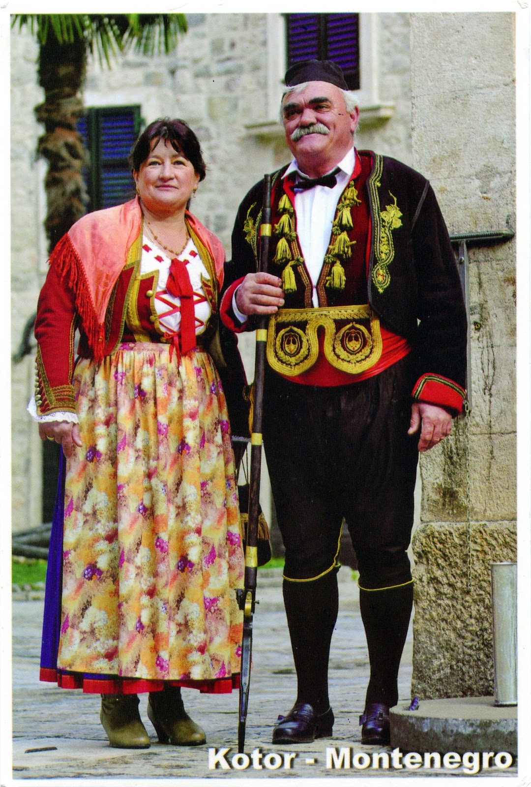
1150 MONTENEGRO (Kotor) - A couple in traditional costumes

$
0
0

Slavs (including Croats and Serbs) have lived in the area of Montenegro since the 6th and 7th centuries in the medieval principalities of Doclea and Zeta, and the area got its present name (Montenegrin: Crna Gora, which means Black Mountain) during the rule of the Crnojević dynasty. It was part of medieval Serbia during 13th century and first half of the 14th century, but Ottoman conquest of the Balkans resulted in separation from Serbia and re-emergence of Zeta. In the 19th century national romanticism among the South Slavs fueled the desire for re-unification. Regarding the linguistic and ethnic identity of Montenegrins, there is an ongoing controversy, some supporting the ideea that they aren't a distinct group, but only a subgroup of Serbian people. Whatever the truth, the many similarities between Serbs and Montenegrins not be questioned. The Bay of Kotor, known also as Boka, is a winding bay of the Adriatic Sea, in fact a ria of the disintegrated Bokelj River which used to run from the high mountain plateaus of Orjen. The inhabitants of Boka and adjacent regions are the Bokelj or Bokez people, who are an ethnic South Slavic community, many of whom nationally identify as being Montenegrin, Serb or Croat, or others. Most are Eastern Orthodox, while some are Roman Catholics.

Read more »

1151 UNITED ARAB EMIRATES (Abu Dhabi) - Sheikh Zayed Grand Mosque

$
0
0

Built between 1996 and 2007 in Abu Dhabi, the capital city of the UAE, Sheikh Zayed Grand Mosque is the eighth largest mosque in the world (with a capacity for 40,000 worshippers), and is considered to be the key for worship in the country. It was initiated by the first Ra’îs (president) of the UAE, HH Sheikh Zayed bin Sultan Al Nahyan, who wanted to establish a structure which unites the cultural diversity of Islamic world, the historical and modern values of architecture and art. It features 82 domes, over a 1,000 columns, 24 carat gold gilded chandeliers and the world's largest hand knotted carpet (5,627 m2). The main prayer hall is dominated by one of the world’s largest chandeliers (10m in diameter, 15m in height and weighing 12 tonnes). There are four minarets on the four corners of the courtyard which rise about 107 m in height. The courtyard, with its floral design, measures about 17,000 m2, and is considered to be the largest example of marble mosaic in the world. The mosque's first ceremony was the funeral of its namesake, Sheikh Zayed, who is buried at the site.

Read more »

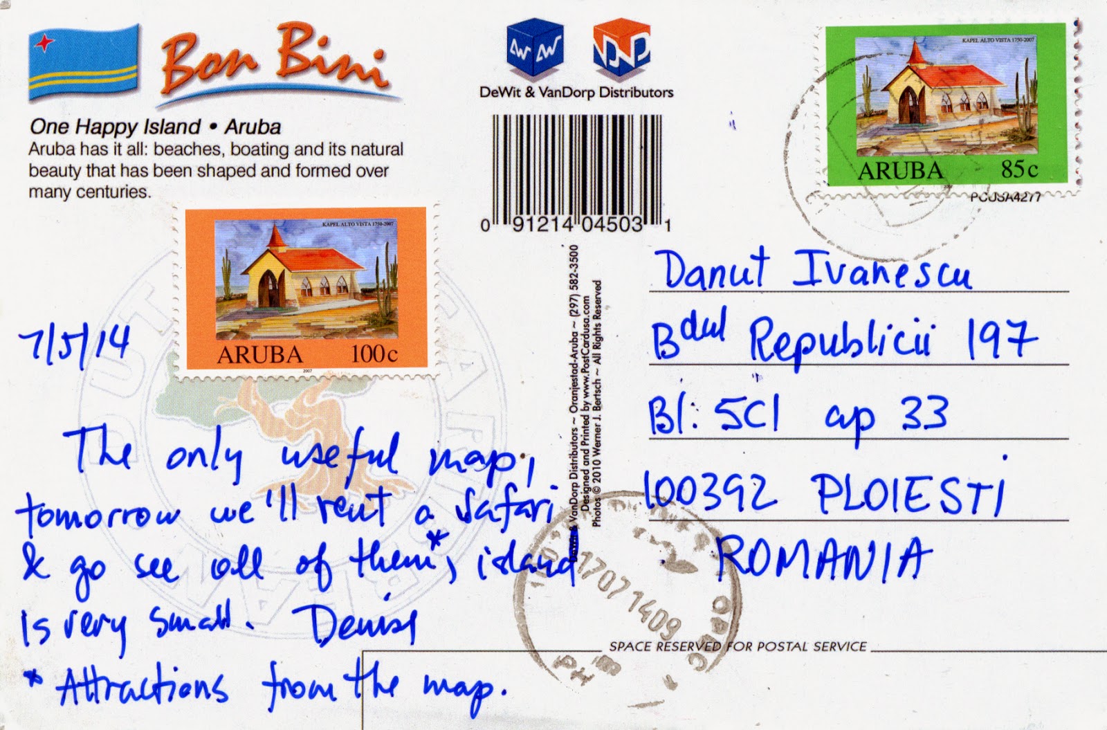
1152-1154 ARUBA - The map of the country

$
0
0

Located about 1,600km west of the Lesser Antilles in the southern Caribbean Sea and 27km north of the coast of Venezuela, Aruba forms, together with Bonaire and Curaçao, a group referred to as the ABC islands. On the other hand, Aruba and the other Dutch islands in the Caribbean are often called the Netherlands Antilles or the Dutch Caribbean. It is one of the four constituent countries that form the Kingdom of the Netherlands, along with the Netherlands (which comprises not only the European land, but also Bonaire, Sint Eustatius, and Saba), Curaçao and Sint Maarten. A generally flat, it lies outside the hurricane belt, and, unlike much of the Caribbean region, has a dry climate and an arid, cactus-strewn landscape. It has white sandy beaches on the western and southern coasts of the island, relatively sheltered from fierce ocean currents.


Aruba's first inhabitants were Caquetíos Amerinds from the Arawak tribe, who migrated there from Venezuela, and Europeans first learned of it following the explorations by Amerigo Vespucci and Alonso de Ojeda. Because it had low rainfall, it was not considered profitable for the plantation system and the economics of the slave trade. Since 1636, it has been under Dutch administration, which left the Arawaks to farm and graze livestock, and used the island as a source of meat for other Dutch possessions in the Caribbean. The population is estimated to be 80% mixed Black/White/Caribbean Amerindian and 20% other ethnicities, and the Arawak heritage is stronger on Aruba than on most Caribbean islands. The official languages are Dutch and - since 2003 - Papiamento, a language derived from African and Portuguese languages with some influences from American Indian languages, English, Dutch and Spanish.


Aruba has one of the highest standards of living in the Caribbean region, its economy being dominated by tourism, gold mining, phosphate mining, aloe export, and petroleum refining. About three quarters of its gross national product is earned through tourism or related activities. The capital and largest city of Aruba is Oranjestad (Orange Town), located on the southern coast near the western end of the island. The town was built around Fort Zoutman shortly after it was built in 1796, and was named in 1820 after the first King Willem van Oranje-Nassau (William of Orange-Nassau) - the first heir to the Dutch House of Orange.

Read more »

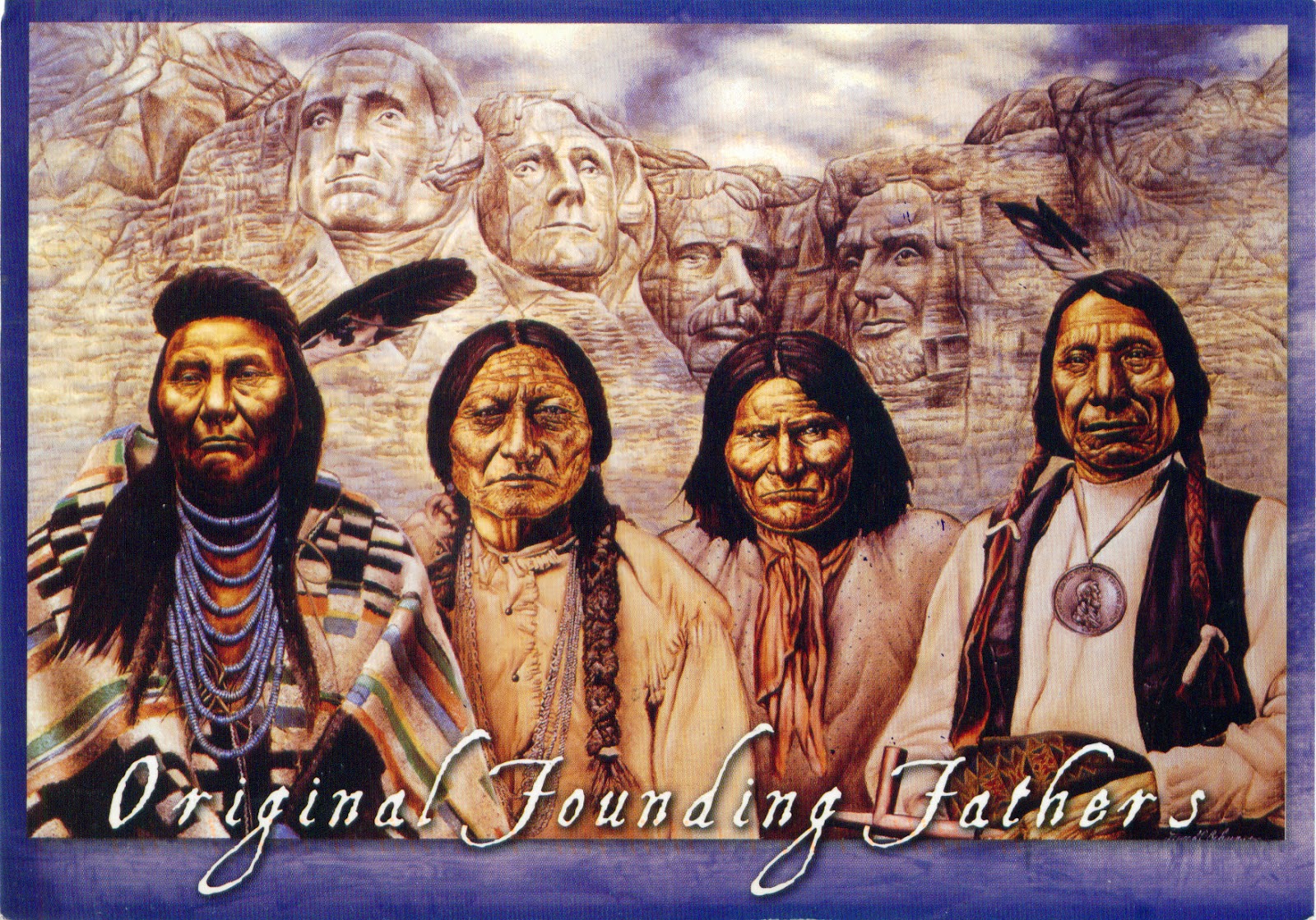
1155, 1156 UNITED STATES (South Dakota) - Presidents and Founding Fathers

$
0
0

The Mount Rushmore National Memorial is a sculpture carved into the granite face of Mount Rushmore (Lakota Sioux name: Six Grandfathers) near Keystone. Sculpted by Danish-American Gutzon Borglum and his son, Lincoln Borglum, it features 18 m sculptures of the heads of four United States presidents: George Washington (1732–1799), Thomas Jefferson (1743–1826), Theodore Roosevelt (1858–1919), and Abraham Lincoln (1809–1865). Historian Doane Robinson is credited with conceiving the idea of this sculpture, in order to promote tourism in the region. Construction on the memorial began in 1927, and the presidents' faces were completed between 1934 and 1939. Upon Gutzon Borglum's death in March 1941, his son Lincoln Borglum took over construction. Although the initial concept called for each president to be depicted from head to waist, lack of funding forced construction to end in late October 1941.


Mount Rushmore is controversial among Native Americans because the United States seized the area from the Lakota tribe after the Great Sioux War of 1876. Members of the American Indian Movement led an occupation of the monument in 1971, naming it Mount Crazy Horse. In 2004, the first Native American superintendent of the park was appointed. Gerard Baker has stated that he will open up more "avenues of interpretation", and that the four presidents are "only one avenue and only one focus." The Crazy Horse Memorial is being constructed elsewhere in the Black Hills to commemorate the famous Native American leader and as a response to Mount Rushmore. It is intended to be larger than Mount Rushmore and has the support of Lakota chiefs; the Crazy Horse Memorial Foundation has rejected offers of federal funds.

Read more »

1157 POLAND - The map and the flag of the country

$
0
0

Located between Germany, the Czech Republic, Slovakia, Ukraine, Belarus, Kaliningrad Oblast (a Russian exclave) and Lithuania, Poland is an almost unbroken plain reaching from the Baltic Sea in the north, to the Sudetes and Carpathian Mountains in the south. Within that plain, terrain variations run in bands east to west. The Baltic coast has two natural harbors (Gdańsk Bay and Bay of Pomerania), and the northeastern region, with more than 2,000 lakes, is densely wooded and sparsely populated. Its capital and largest city is Warsaw, established on the Vistula River at about 1300 by the Płock prince Bolesław II of Masovia, known as the city of palaces, royal gardens and grand parks.

Read more »

1158 MADAGASCAR - Les baobabs amoureux in Morondava

$
0
0

Once upon a time, a young man and a young woman of two nearby villages fell in love from each other. Unfortunately both had already an assigned partner and had to marry separately in their respective villages. However, the impossible couple dreamed of a common eternity life and having a child together and secretly asked help to their god. Both baobabs were born and now live they for eternity as one as the couple always wished. So says the legend that appeared the two baobabs known as Les baobabs amoureux (the Lovers baobabs), located at 7km to the northwest of the famous Avenue or Alley of the Baobabs, a prominent group of baobab trees lining the dirt road between Morondava and Belon'i Tsiribihina in the Menabe region in western Madagascar. Along the 260m of the avenue are 20-25 trees about 30m in height, known locally as renala (Malagasy for "mother of the forest"), a legacy of the dense tropical forests that once thrived on Madagascar.

Read more »

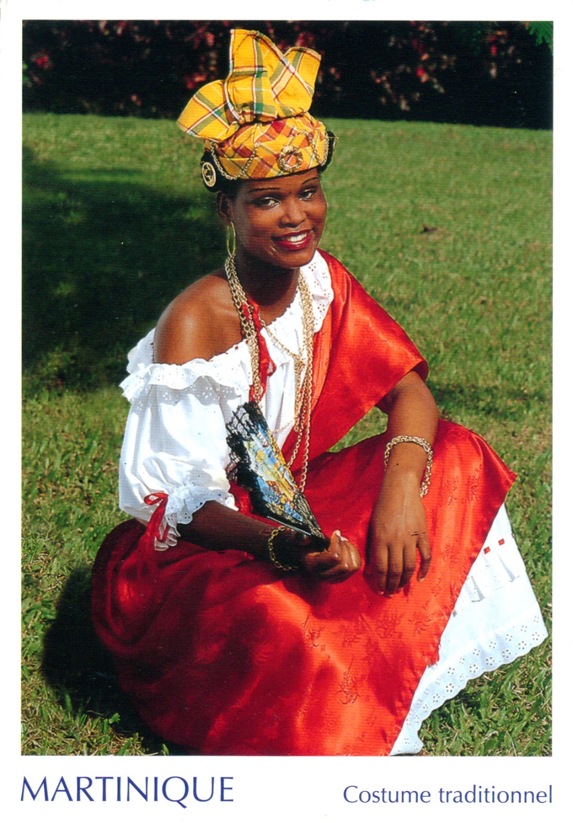
1159 MARTINIQUE - Woman dressed into traditional Creole clothes

$
0
0

Located in Lesser Antilles in the eastern Caribbean Sea, Martinique, as also Guadeloupe, is an overseas region of France, so its culture blends French and Caribbean influences. The city of Saint-Pierre was often referred to as the "Paris of the Lesser Antilles". Most of Martinique's population is descended from enslaved Africans brought to work on sugar plantations during the colonial era, generally mixed with some French, Amerindian (Carib people), Indian (Tamil), Lebanese or Chinese ancestry. Many Martinicans speak, in addition to French (official), Martiniquan Creole, a subdivision of Antillean Creole that is virtually identical to the varieties spoken in Saint Lucia and Dominica.

Read more »

1160 CAMBODIA (Siem Reap) - Traditional Apsara dancer

$
0
0

Apsaras are female spirits of the clouds and waters in Hindu and Buddhist mythology, assimilated to some extent with nymphs from european mythology. They are youthful and elegant, and superb in the art of dancing, being associated with fertility rites. They are often the wives of the Gandharvas, the court musicians of Indra. They dance to the music made by the Gandharvas, usually in the palaces of the gods, entertain and sometimes seduce gods and men. They are said to be able to change their shape at will, and rule over the fortunes of gaming and gambling. Apsaras represent an important motif in the stone bas-reliefs of the Angkorian temples in Cambodia, about which I wrote here.

Read more »

1161 BANGLADESH (Dhaka) - National Martyrs' Memorial in Savar

$
0
0

Located at about 35km northwest of Dhaka, the capital city of the country, Jatiyo Smriti Soudho, the National Monument for the Martyrs of the Bangladesh Liberation War of 1971 (which brought independence and separated Bangladesh from Pakistan) was designed by Syed Mainul Hossain and inaugurated at 16 December, 1982. The monument is composed of 7 isosceles triangular pyramid shaped structures, with the middle one being the tallest. The highest point of the monument is 50m. There is an artificial lake, and several mass graves in front of the main monument. From the main gate one can see the monument axially, but to reach there one has to walk through different levels of red pavements and cross a lake - all these representing the struggle for independence.

Read more »

1162 UNITED STATES (Georgia) - The map of State of Georgia

$
0
0

Located in the southeastern United States, on the shore of the Atlantic Ocean, between Florida, South Carolina, Alabama, Tennessee and North Carolina, Georgia, also known as Peach State, was established in 1732, the last of the original Thirteen Colonies. Named after King George II of Great Britain, it was the fourth state to ratify the U.S. Constitution, but also one of the original seven Confederate states, and the last one to be restored to the Union, on July 15, 1870. The state's capital and its most populous city is Atlanta, built in 1840 as Terminus, the "zero milepost" of  Western and Atlantic Railroad. The northern part of the state is in the Blue Ridge Mountains, a mountain range in the Appalachian Mountain system. The central Piedmont extends from the foothills to the fall line, where the rivers cascade down in elevation to the continental coastal plain of the southern part of the state. If Georgia were a stand-alone country, it would be the 28th largest economy in the world. The state symbols are Brown Thrasher, Cherokee Rose and White Oak, its motto is "Wisdom, Justice, and Moderation", and its song is Georgia on my mind.

Read more »

1163-1166 ARUBA - California Lighthouse

$
0
0

Located near Arashi Beach on the northwest tip of Aruba, in the area known as Hudishibana, California Lighthouse was named for the British wooden steamship California, which wrecked nearby on September 23, 1891, after sailing from Liverpool toward Central America. On board, passengers were partying hard when the wreck occurred. Meanwhile, the crew was more practical, tossing cargo overboard as the sinking vessel hit the coast so the merchandise could be sold in Oranjestad - or so the story goes.


Two decades later, a French architect designed the striking edifice that came to be known as the California Lighthouse. Construction on the lighthouse began in 1914 and took two years to complete. The tower was built using stone blocks quarried in the area. Meanwhile, the top - which stands at 30m high - was made of metal to house the mood-altering light that shines onto the landscape today. It is conical, but has an octagonal base and it is unpainted (sand coloured). Around the lighthouse are acres of stoned-filled flat land, and a area called California White Sand Dunes.


It was formerly open to the public until a suicide occurred, which prompted authorities to restrict public access to the lighthouse. Now it is a major tourist attraction, because any time of day or night is a great time to visit the lighthouse for a 360 degree view, but the sunset is hands down the right time of day to be there as the big orange ball of fire gently dips into the Caribbean Sea. Right next to the California Lighthouse is a very good Italian restaurant named La Trattoria El Faro Blanco (The White Lighthouse Restaurant).


Read more »

1167 BULGARIA (Blagoevgrad) - A woman from Gotse Delchev with traditional headdress

$
0
0

I wrote here a little about the bulgarian traditional clothes, and about the main bulgarian ethnographic regions, so I don't insist for now. The woman in the postcard is from Gotse Delchev, in the south-west of the country. Prior to the 20th century, for weddings the hair was arranged in complex styles formed with multiple plaits; in the north and southwest, brides wore a specific headband made of decorative metal chains forming a crown. Married women covered their heads with scarves of colored silk or cotton (which could be square, triangular or rectangular, small or large), sometimes worn over a small hat. Bridal headdresses usually had a large square headscarf or scarf (mesal) 2m to 3m long and decorated with embroidery and long fringes on both ends. The headscarf was worn over cylinder or cone shape low hats. It were folded in the middle and placed on head, or could be worn over a pad, with the ends hanging loose at back. The style of jewelry worn with Bulgarian ethnic dress was strongly influenced by Ottoman fashions but with certain ancient elements, such as the over-the-ear pendants. During the period of national revival, workshops in the prosperous towns made earrings, bracelets, necklaces, and rings of silver filigree or cast copper or silver, often decorated with enamel.

Read more »

1168 UNITED ARAB EMIRATES - Traditional arabian horse rider

$
0
0

Admired and desired, immortalised by pen and brush, the Arabian horse had, arguably, more influence on civilisation than any other equine breed. The nomadic Bedouin were the first who tame the wild Arabian, but they treated it as a friend and ally rather than a beast of burden. The camel was a means of survival, providing meat, milk, leather and transportation on the long treks across the desert sands. However, the horse’s bravery, endurance, speed, agility and loyalty were vital for inter-tribal raids and skirmishes. But it would also provide the bridge for momentary truces. The rules of hospitality dictated that even in times of war, the unexpected guest should be welcomed and given nourishment. In token, the warrior’s mare’s bridle would be hung from the pole of the host’s tent where the men would eat together.

Read more »

1169 MONGOLIA - The statue of Sükhbaatar in Ulaanbaatar

$
0
0

The central square of Ulaanbaatar, the capital city of Mongolia, is Sükhbaatar Square, named after the equestrian statue of Damdin Sükhbaatar, located directly in front of the Saaral Ordon (Government Palace). Sükhbaatar (literally meaning "Axe hero") was a founding member of the Mongolian People's Party and leader of the Mongolian partisan army that liberated Khüree (then called Ulaanbaatar) during the Outer Mongolian Revolution of 1921. Enshrined as the "Father of Mongolia's Revolution", he is remembered as one of the most important figures in Mongolia's struggle for independence. He had close relations with the last Khaan of Mongolia, Bogd Gegeen, and didn't intend to spread Bolshevik ideas in Mongolia. Therefore, his death at only 30 years old aroused suspicion. The words he apparently proclaimed at the time are engraved on the bottom of the statue: "If we, the whole people, unite in our common effort and common will, there will be nothing in the world that we cannot achieve, that we will not have learnt or failed to do."

Read more »

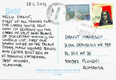
0733, 0734, 1136, 1170 CROATIA (Split-Dalmatia) - Historical Complex of Split with the Palace of Diocletian (UNESCO WHS)

$
0
0

Posted on 11.07.2013, 09.07.2014, and 29.07.2014
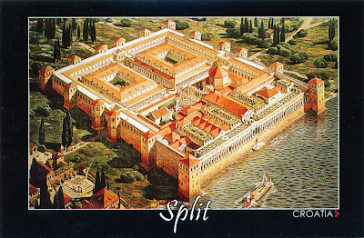
It is said that the Diocletian's Palace is placed on the center of the city of Split. For the sake of accuracy, I must say that in fact the city was built around the palace. It was began in 293 AD, and was finished in 305, right on time to receive its owner, who retired there, becoming the first Roman Emperor to voluntarily remove himself from office. He will enjoy only 6 years by the pleasures offered by the opulent refuge, because he committed suicide in 311. After the Romans abandoned the site, the palace remained empty until the 7th century, when nearby residents fled to the walled palace to escape invading barbarians, and so was born the current city. After the Middle Ages the palace was unknown in the West until the Scottish neo-classical architect Robert Adam discovered the ruins in 18th century.


As can be seen in the first postcard, a reconstruction of the palace in its original appearance, made by the French architect and archaeologist Ernest Hébrard in 1912, the ground plan of the assembly is an irregular rectangle (approximately 160m x 190m), with towers on three sides. The palace is enclosed by walls, and at times, it housed over 9000 people. Only the southern facade, the one seaward, was unfortified. The palace combines therefore the qualities of a luxurious villa with those of a military camp. A monumental gate in the middle of each of the walls led to an enclosed courtyard. The southern sea gate (the Porta Aenea) was simpler in shape and dimensions than the other three. The transverse road (decumanus) linking the eastern gate (the Silver Gate or Porta Argentea) and western gate (the Iron Gate or Porta Ferrea) divided the complex into two-halves.


A monumental court, called the Peristyle, formed the northern access to the imperial apartments. It also gave access to Diocletian's mausoleum on the east (now Cathedral of St. Domnius), and to three temples on the west (two of which are now lost, the third having become a baptistery, originally being the temple of Jupiter). The northern half of the palace, divided in two parts by the main north-south street (cardo) leading from the Golden Gate (Porta Aurea) to the Peristyle, is less well preserved. The palace was built of white local limestone, marble of high quality, tuff and brick, and was decorated with numerous 3500 year old granite sphinxes, originating from the site of Egyptian Pharaoh Thutmose III. Only three have survived the centuries. In the left is the Bell Tower, constructed in the year 1100 AD, in the Romanesque style, the city's main symbol.


The Cathedral of St. Domnius, known locally as the Sveti Dujam, is the Catholic cathedral in Split, actually a complex of a church and a bell tower. Strictly the church is dedicated to the Virgin Mary, and the bell tower to Saint Duje. The cathedral, consecrated at the turn of the 7th century, is regarded as one of the oldest Catholic cathedral in the world that remains in use in its original structure. The structure itself, built in 305 as the Mausoleum of Diocletian, is the second oldest structure used by any Christian Cathedral. The Bell Tower was constructed in the year 1100, in the Romanesque style.

Read more »

1171 JORDAN - Jerash Archaeological City (UNESCO WHS - Tentative List)

$
0
0

Situated in the north of Jordan, 48km north of the capital Amman towards Syria, Jerash is the site of the ruins of the Greco-Roman city of Gerasa, also referred to as Antioch on the Golden River. Ancient inscriptions establish the foundation of the city as being by Alexander the Great or his general Perdiccas. It was a city of the Decapolis (Ten Cities), a group of ten cities on the eastern frontier of the Roman Empire in Jordan, Israel and Syria. Recent excavations show that Jerash was already inhabited during the Bronze Age (3200 BC - 1200 BC). The Romans, who conquest the city in 63 BC, ensured security and peace in this area, which enabled its people to devote their efforts to economic development and encouraged civic building activity. The Persian invasion in 614 caused the rapid decline of Jerash, and in 749 a major earthquake destroyed much of the city. During the period of the Crusades, some of the monuments were converted to fortresses. Small settlements continued in Jerash during the Ayyubid, Mameluk and Ottoman periods.

Read more »

1172 SWEDEN - Swedish Royals on Sweden's National Day

$
0
0

National Day of Sweden is a national holiday observed in Sweden on the 6th of June every year. Prior to 1983, the day was celebrated as Swedish Flag Day. The tradition of celebrating this date began in 1916 at the Stockholm Olympic Stadium, in honour of the election of King Gustav Vasa in 1523, as this was considered the foundation of modern Sweden; and on the same date in 1809, Sweden adopted a new constitution that included the establishment of civil rights and liberties. In 2005 it became an official Swedish public holiday, replacing Whit Monday.

Read more »

1173 UNITED STATES (Florida) - Spaceship Earth and Monorail Peach in Epcot

$
0
0

The Walt Disney World Resort, or simply Disney World, is an entertainment complex in Lake Buena Vista, Florida, opened on October 1, 1971. The property covers 16,997 ha, in which it houses 24 themed resort hotels, four theme parks, two water parks, four golf courses, and numerous additional recreational and entertainment venues. Magic Kingdom was the first and original theme park to open in the complex followed by Epcot, Disney's Hollywood Studios, and Disney's Animal Kingdom, opened later throughout the 1980s and 1990s. Epcot (an acronym for Experimental Prototype Community of Tomorrow), the second of theme parks, spans 120 ha, more than twice the size of the Magic Kingdom park. Dedicated to the celebration of human achievement, namely technological innovation and international culture, is often referred to as a "Permanent World's Fair."

Read more »

1174-1179 UNITED NATIONS - UN at a glance

$
0
0

The United Nations (UN) is an intergovernmental organization established on 24 October 1945, after the WWII, to prevent another such conflict, actually a replacement for the ineffective League of Nations. At its founding, the UN had 51 member states; there are now 193. Its objectives include maintaining international peace and security, promoting human rights, fostering social and economic development, protecting the environment, and providing humanitarian aid in cases of famine, natural disaster, and armed conflict. The flag of the UN was adopted on October 20, 1947, and consists of the official emblem of the UN in white on a blue background. The emblem's design is described as: "A map of the world representing an azimuthal equidistant projection centred on the North Pole, inscribed in a wreath consisting of crossed conventionalized branches of the olive tree, . . . The projection of the map extends to 60 degrees south latitude, and includes five concentric circles."


The UN Headquarters is situated in the Turtle Bay neighborhood of Manhattan, New York City, on spacious grounds overlooking the East River, and enjoys extraterritoriality. The complex was constructed in stages with the core complex completed between 1948 and 1952. Rather than hold a competition for the design of the facilities for the headquarters, the UN decided to commission a multinational team of leading architects to collaborate on the design. The American architect Wallace K. Harrison was named as Director of Planning, and a Board of Design Consultants was composed of architects, planners and engineers nominated by member governments. The board consisted of N. D. Bassov of the Soviet Union, Gaston Brunfaut (Belgium), Ernest Cormier (Canada), Le Corbusier (France), Liang Seu-cheng (China), Sven Markelius (Sweden), Oscar Niemeyer (Brazil), Howard Robertson (United Kingdom), G. A. Soilleux (Australia), and Julio Vilamajó (Uruguay).


The diminutive site on the East River necessitated a "Rockefeller Center"-type vertical complex, thus, it was a given that the Secretariat would be housed in a tall office tower. During daily meetings from February to June 1947, the collaborative team produced at least 45 designs and variations. After much discussion, Harrison, who coordinated the meetings, determined that a design based on Niemeyer's project 32 and Le Corbusier's project 23 would be developed for the final project. Le Corbusier's project 23 consisted of a large block containing both the Assembly Hall and the Council Chambers near the centre of the site with the Secretariat tower emerging as a slab from the south. Niemeyer's plan was closer to that actually constructed, with a distinctive General Assembly building, a long low horizontal block housing the other meeting rooms, and a tall tower for the Secretariat. Le Corbusier and Niemeyer merged their schemes 23–32, and this, along with suggestions from the other members of the Board of Design Consultants, was developed into project 42G.


The complex includes a number of major buildings. While the Secretariat building (154m) is most predominantly featured in depictions of the headquarters, it also includes the domed General Assembly building, the Dag Hammarskjöld Library, as well as the Conference and Visitors Center, which is situated between the General Assembly and Secretariat buildings, and can be seen only from FDR Drive or the East River. Just inside the perimeter fence of the complex stands a line of flagpoles where the flags of all 193 UN member states, plus the UN flag, are flown in English alphabetical order.


The complex is also notable for its gardens and outdoor sculptures. One of the iconic sculptures is the Knotted Gun, called Non-Violence, a bronze statue of a Colt Python revolver with its barrel tied in a knot, which was a gift from the Luxembourg government. It was made by Swedish artist Carl Fredrik Reuterswärd after the singer, songwriter and peace activist, founder member of the Beatles, John Lennon was murdered in New York on 8 December 1980. There are currently 16 copies of the sculpture around the world, nine of them in Sweden. Since 1993, the Non-Violence sculpture is the symbol of The Non-Violence Project, a non-profit organisation, promoting social change with violence prevention education programs.


The UN has three regional headquarters, opened in Geneva (Switzerland) in 1946, Vienna (Austria) in 1980, and Nairobi (Kenya) in 2011. These help represent UN interests, facilitate diplomatic activities, and enjoy certain extraterritorial privileges, but only the main headquarters in New York contains the seats of the principal organs of the UN. All fifteen of the United Nations' specialized agencies are located outside New York. The United Nations Office at Geneva (UNOG) is located in the Palais des Nations building constructed in Ariana Park for the League of Nations between 1929 and 1938, and expanded in the early 1950s and late 1960s. An international architectural competition was opened in 1926, on which participated 377 projects, but the jury was unable to decide on a winner. Ultimately, the five architects behind the leading entries were chosen to collaborate on a final design: Julien Flegenheimer of Switzerland, Camille Lefèvre and Henri-Paul Nénot of France, Carlo Broggi of Italy and József Vágó of Hungary. The Palace and its buildings constitute the second-largest building complex in Europe after Versailles.

Read more »
1180, 1181 ROMANIA (Tulcea) - Danube Delta (UNESCO WHS)

$
0
0

The Danube Delta is the second largest river delta in Europe, after Volga Delta, and is the best preserved on the continent. The greater part lies in Romania (Tulcea county), while its northern part, on the left bank of the Chilia arm, is situated in Ukraine (Odessa Oblast). The modern Danube Delta began to form after 4000 BCE in a bay of the Black Sea, when the sea rose to its present level. A sandy barrier blocked the Danube bay where the river initially built its delta. Probably 40 percent of the Delta was built in the last 1000 years. The reserve is vast, with numerous freshwater lakes interconnected by narrow channels featuring huge expanses of aquatic vegetation. This is the largest continuous marshland on Europe, which includes the greatest stretch of reedbeds in the world, which form floating or fixed islands of decaying vegetation. The Razelm-Sinoe complex to the south comprises several large brackish lagoons separated from the sea by a sandbar. The higher ground supports stands of willow, popular, alder and oak. There are also sandy areas covered with feather grass and other steppe species. Forest elements are best observed in Letea Forest (in the first postcard) where a series of bands occur along dunes up to 250 m long and 10 m wide.


Situated on major migratory routes, and providing adequate conditions for nesting and hatching, the Danube Delta is a magnet for birds from six major eco-regions of the world, including the Mongolian, Arctic and Siberian. There are over 320 species of birds found in the delta during summer, of which 166 are hatching species and 159 are migratory. Over one million individuals (swans, wild ducks, bald coots, etc.) winter here. An interesting ethologic aspect appearing enhanced by the conditions of the Danube Delta (especially by the floods) is represented by egg laying in common nests. Thus, as a consequence of the general lack of egg-laying places, especially at flood time when a great part of the aquatic-species nests are flooded, the birds this way affected go on laying eggs in alien nests either belonging to the same species or to species of the same families.

Read more »
Viewing all 2426 articles
Browse latest View live